350th Expedition Anniversary of Marquette and Joliet on the Mississippi River…Participate if You Can! June 16-18, 2023, Prairie du Chien, Wisconsin

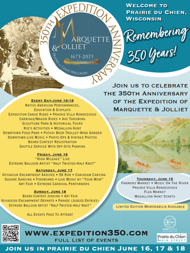
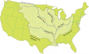
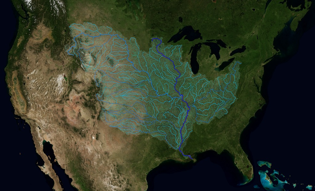
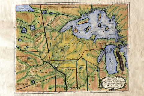
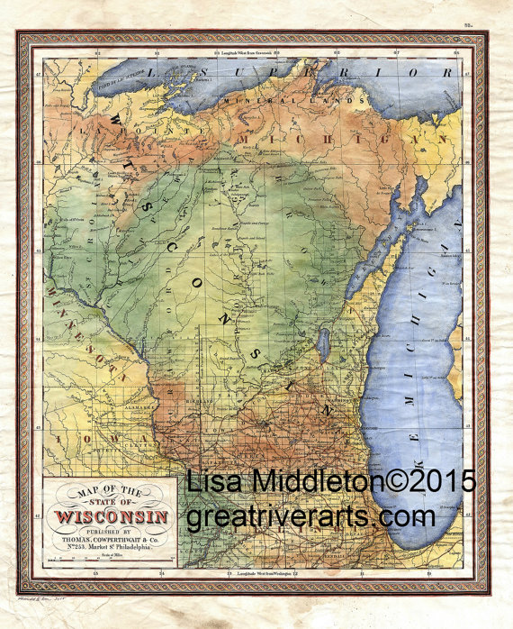
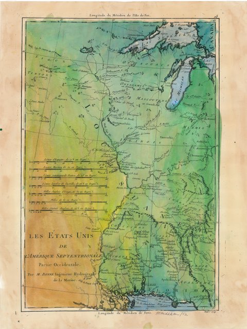
350 years ago, the course of history was changed forever. In May of 1673, Father Marquette and explorer Louis Jolliet set out from Green Bay, Wisconsin and traveled along waterways from the Great Lakes to the Mississippi River. This expedition, when many cultures met for the first time, opened commerce and transportation routes still used today.

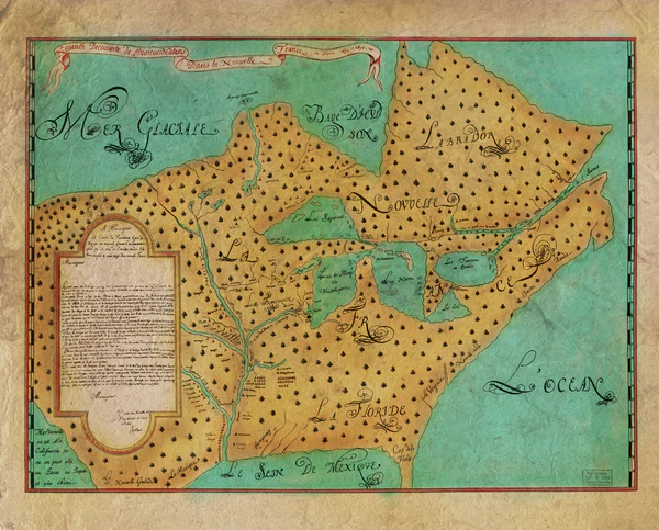
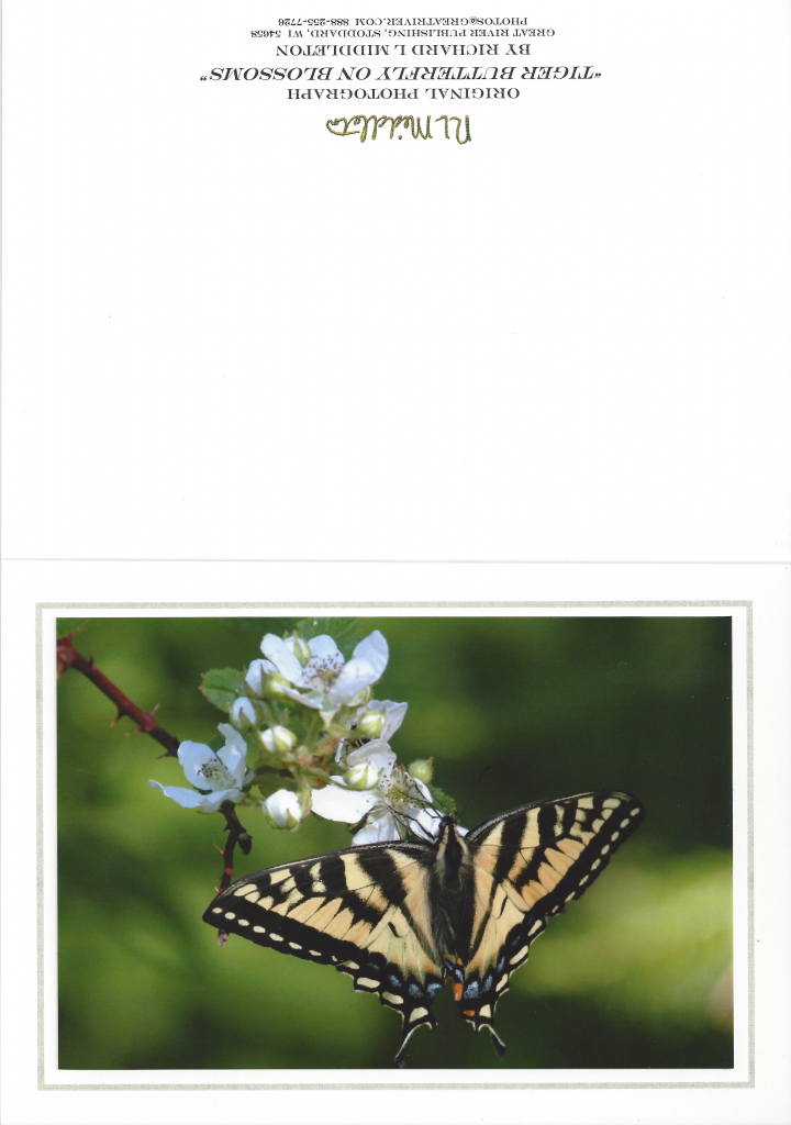
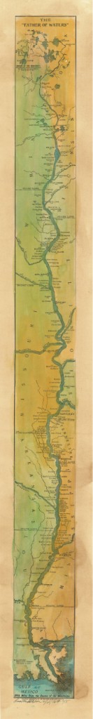
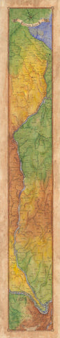
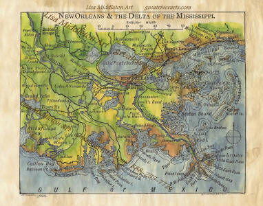
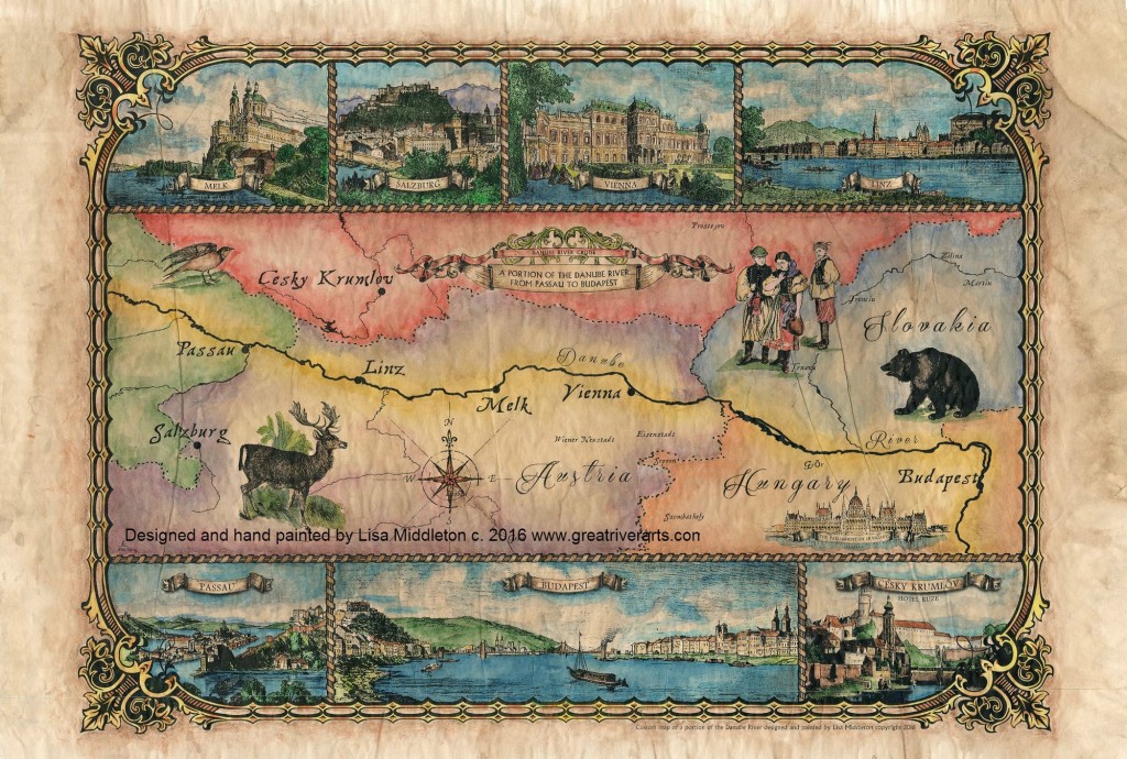
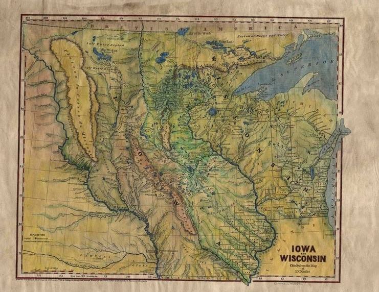
The Lost Map of Joliet now available at Great River Arts … hand painted by Lisa Middleton (Click Blue Link to Study or Purchase!)

This summer, from June 16th to June 18th, Prairie du Chien and Crawford County, Wisconsin celebrate the deep and continuing regional history represented by this expedition. The 350th Expedition Celebration offers the opportunity to better understand our region’s rich history. A history that began with the many native nations who lived on this land for centuries before the French explorers saw it for the first time. At the celebration, you will experience historical reenactments by the voyageurs and performances from native nations.

This 2023 celebration commemorates the 350th anniversary of Marquette and Jolliet’s expedition reaching the Mississippi River at Prairie du Chien. Come and experience this historic anniversary. In addition to the historical reenactments and native american performances, event go-ers will enjoy the Prairie Villa Rendevous, flea market, farmer’s market, old-tyme photo opportunities, carriage rides, ax throwing, flint knapping and other historical demonstrations and displays, medallion hunt, old-time kids games, carnival performances (juggling, stilt walkers, hula hoop workshop), historical tours, parade, music, fireworks, food and so much more. (TRAVEL WISCONSIN)

FRENCH HERITAGE CONFERENCE

3rd Annual Chicago French Heritage Society is in Prairie du Chien June 15-17

In addition to the Expedition Celebration, the third annual FHC conference will be held in Prairie du Chien from June 15-17. I believe anyone may register for a series of fascinating historical presentations. Events list follows:

June 15, 2023: Full-day Conference and buffet lunch at The Barn, 32800 County Road K

June 16, 2023: Full-day of guided site visits led by Mary Elise Antoine, FHC WI Ambassador and President Emeritus of the Prairie du Chien Historical Society

June 17, 2023: Marquette & Jolliet 350th Expedition Anniversary Prairie du Chien, WI

Full itinerary and additional details are online and available at: Third Annual French Heritage Corridor Conference – French Heritage Society(opens in a new tab)

Explore Minnesota Map Art

The Minneapolis Star Tribune featured today the Gunflint Trail above Grand Marais in Minnesota. Makes me think folks might just enjoy exploring our maps of Minnesota painted by Lisa Middleton. An easy place to start is with our Gunflint Trail map!

But we have many more maps of favorite lakes, historic maps, original art! Great to explore on a winter afternoon! Click here:

https://great-river-arts.myshopify.com/searchtype=product&q=Minnesota+great+lakes


Monarchs on the Move

We have been watching our local Monarch butterflies since early August, fluttering around our wetland Milkweed and Joe Pye weeds.

With the grand-kids, we have been able to observe the singular egg, the distinctive caterpillars who ate the leaves voraciously…like lawn mowers… the delicate chrysalis, and finally, the magical moments of transformation to an adult butterfly!

Please enter Monarch in the Search Box in the upper right to see more on Migrating Monarchs from GreatRiver.com

Boaters in September will find them frequenting the Mississippi River on their meandering, multi-generational migration to Mexico and back.

Yes! Great River Arts offers quality note cards, Prints, and Map art for a variety of Butterfly Species. Find beautiful hand-painted map art and quality prints of Mexico and the Caribbean! Visit greatriverarts.com

Sandwich Islands, Mexico, Central America, Caribbean, West Indies1878

Exploring the Galapagos Islands!

WATERWAY CRUISE REPORT

The Galapagos Island cruise reports are among our most popular Waterway Cruise Reports.. .

The best part of traveling the Galapagos is an amazing up close and persoal experience with the wildlife who call it home. This seal really loved my backpack!

PART TWO of OUR WATERWAYS CRUISE REVIEW OF VISITING THE GALAPAGOS ISLANDS…. Click HERE to read PART ONE.

Alex was our preferred naturalist… mainly because of his love of the islands, and because of his 20 years of experience! But for those whose personal perspective is that this was a “vacation” and no “mandatory learning” was allowed, we had a second naturalist whose main focus was “learn a little” and have a great time! Every Galapagos naturalist today is professionally trained to interpret and protect this unique natural heritage.

On my first open ocean snorkeling excursion, I panicked and clung to the ladder.

“Alex,” I urged, “don’t wait for me. I’ll just hang here for a while.”

“I don’t go anywhere unless you decide to come with me, or get back in the boat,” he explained. “I don’t leave you in the water alone.” I felt absolutely safe with Alex from that point forward.

Snorkeling, panga rides, and kayaking were all available options for daily water-based activities. Snorkeling was by far the most popular… Turtles, white-tipped sharks, swimming with sea lions, and even “circling-up” when visited by several hammerhead sharks provided highlites on our Galapagos cruise. Oh yes, and we were joined by a pod of leaping dolphins during one of many memorable panga excursions!

“I really could not believe it was ME out there snorkeling with Hammerhead sharks!” one Minnesota passenger exalted.   And sea turtles were ABUNDANT in the clear waters!
 

Twice each day, the naturalists led us ashore for an island hike. An afternoon nap was mandatory, so that everyone had the energy to do the really important stuff… like hiking among the booby’s and iguanas, and magnificent Frigate Birds.

The AMAZING thing is  that these creatures truly have no fear of humans!! It was as if we had entered into the Garden of Eden.

While it is not necessary to  be   a student athlete to visit the Galapagos Islands, for the first time on any cruise, we found ourselves to be among the older visitors, rather than the younger!

It IS necessary to be able to hike for a mile or two… some of it over rocky lava surfaces, or up and down short steep slopes.

“Wet landings” are common, so be prepared to swing your legs over the side of a rubber panga and in the gentle surf!

I did bring two pieces of “gear” that I found incredibly useful…trekking poles that could be unscrewed to fit in a small carry-on suitcase, and lightweight Salomon’s “Amphibian” style hiking shoes with webbing. The trekking poles worked great when we were on lava rocks.

The specialized water/hiking shoes were great for wet landings. The webbing meant shoes dried quickly. The hiking soles stuck like glue to wet rock and afforded comfortable cushioning for the rest of the hike.

Casual dress is definitely the order of the day for this cruise!

Lisa’s beautiful maps are also available on Textiles!! If you are planning a wedding, family reunion or other activities on a tropical island, textiles make great gifts for the whole group!!  Click this link to see Options!

To Our Valued Past and Present Wholesale Customers

With the uncertainty of the current moment, Lisa and I just wanted to take a moment to reach out to our past and present customers to let you know that Great River Publishing and Great River Arts are open as always for our precious Wholesale Customers and online purchases.

Our fresh printing of Michael Gillespie’s rail and steamboat era anthologies, Lisa’s newly printed 25′′ 1858 Plantation maps, our timeless favorites, the Father of Waters Ribbon Map and our 4 Volumes of DISCOVER! America’s Great River Road are ready to ship TODAY, Click blue links to see products directly online.

Lisa is prepared for your online wholesale orders at her shopping cart at www.greatriverarts.com Click SHOP to enter the shopping cart and use the code patspecial at checkout and the cart will zero out and we will invoice you manually as we always have, at the same wholesale pricing you expected from Great River Publishing. ( All online purchasers can continue to purchase online with no special code and no minimum purchase! Use keywords in the SEARCH button to find any of Lisa’s beautiful 400 map paintings and destinations.)

Your wholesale telephone order, email order, or other queries are always welcome!! Email: mapart@greatriverarts.com or Lisa at: 406.471.7563

Friends, we more than thank you for your continued support. Many of you have been buying our book, maps, note cards for close to 30 years! It’s hard to express how much I (Pat) have appreciated you through the years. If you have any questions. or concerns, please do not hesitate to contact us. Although Lisa will be taking over the bulk of our wholesale business, always, feel free to contact me … with questions, concerns, or a bit of tutoring on Lisa’s www.greatriverarts.com


Drainage Map of the Mississippi River and its Tributaries. Some Facts and Figures

QUESTIONS! QUESTIONS!
For Jack, who wants to know more about all the tributaries of the Mississippi River: how many there are,  their names, and how long they are!
NPS.gov watershed tributaries

There are some 250 tributaries of the Mississippi which drain a total area of more than 1,247,000 square miles–one third of the nation’s landmass–extending from the Allegheny Mountains in the east to the Rocky Mountains in the west!

We start here with quick facts on the Mississippi River and several navigable tributaries! Please follow links for a little more depth of historical interest and to see our collection of hand-painted maps!

The Mississippi River, from its source at Lake Itasca in Minnesota, to the Gulf of Mexico, is approximately 2,348 miles long. The combined reach of the Missouri-Mississippi Rivers is 3,741 miles–a length exceeded only by the Amazon and Nile rivers. The Mississippi River has shortened by several hundred miles since the days of Mark Twain. Even today it varies 30-50 miles each year.

The widest navigable part of the Mississippi is Lake Pepin, on the Upper Mississippi, where it is approximately 2 miles wide. The average current flows from 1.2 miles per hour nearer Lake Itasca, and about 3 mi per hour nearer New Orleans. Our historic Mississippi River Ribbon Map has been a best-selling Gift for many years.

Yes! The Mississippi River map can be ordered FRAMED and delivered to loved ones from Great River Arts as a uniquely treasured Father’s Day or Mother’s Day Gift!

“This is a beautiful map!! My whole life is on this map! My home town, the towns where my kids live, even New Orleans, my favorite place to vacation!”

TRIBUTARIES OF THE MISSISSIPPI River  … Watershed map
U.S. Geological Survey EROS Center


Remember the great Mississippi River Flood of 1993? It wasn’t just the Mississippi River flooding that wreaked havoc, it was that all those tributaries flooded as well! At one point, the volume of water flowing past St. Louis was eleven times the volume of Niagara Falls!! You may also want to check out our interactive map of which of the tributaries are at flood stage today! Click INTERACTIVE MAPS in the category list, right hand column, to see where the tributaries are at flood level TODAY!!

Lisa now offers her own custom ribbon map designs of both the OHIO RIVER and the Missouri River. Please click on any map image for more info on the map or the tributary. Or PHONE 888-255-7726 to order any map. Click on map images for more info on the tributaries.

192 Missouri River Ribbon Map
017 Arkansa Territory 1827
The Arkansas River forms in the Rocky Mountains in Colorado and meanders 1,450 miles through Kansas, Oklahoma, and Arkansas.  It is the main water source for the state of Arkansas.Click here to see
more Arkansas River facts and Artisan Maps by Lisa Midd

/

Ohio River Ribbon Map

The Ohio River is the second major tributary of the Mississippi. It is formed in Pittsburgh by the junction of the Allegheny and Monongahela River and travels about 980 miles to Cairo, Illinois, and the Mississippi River. Interestingly, today’s Ohio River Basin is approximately the northern extremity of the ancient shallow sea that is represented today by the Gulf of Mexico! Consider that nearly 1/3 of the nation’s water drains past the confluence of the Ohio and Mississippi rivers at Fort Defiance in Cairo, Illinois!  

Click here to see more Ohio River facts and Artisan Maps by Lisa Middleton

The Illinois River

Illinois River Ribbon Map

The Illinois River, cutting through steep rocky bluffs, runs approximately 273 miles (439 km), with some 60 miles of scenic water. It flows through the heart of the State of Illinois, and links the great rivers of the American West with the Great Lakes, the St. Lawrence Seaway, and finally the Atlantic Ocean.

Historically, the Illinois River has had a significant impact on the state’s economy, communities, and peoples. Long before Europeans discovered America, indigenous tribes inhabited the Illinois River Valley and settled on the riverbanks, creating a river culture of their own. In 1673, Father Jacques Marquette and Louis Joliet surveyed the region, canoeing up to the Illinois River via the Mississippi River, hoping to find a route linking the Great Lakes to the Illinois River and the Gulf of Mexico. Today, the Illinois and Michigan Canals are the evidence that their vision became reality.

And for fun, checkout our fascinating 1841 STEAMBOAT MAP OF ILLINOIS
lists all the steamboat stops and distances along the Illinois River and the Mississippi, Ohio and Vermillion Rivers!

Wonderful detail!

119 1841 Steamboat Map of Illinois

Planning for an upcoming CRUISE? We’ve featured several of our SMALL BOAT CRUISE destinations here!
WATERWAY CRUISE REPORTS

Dreaming of a Small Boat Cruise through the Galapagos Islands?

For the moment, at the peak of the 2020 Coronavirus pandemic, dreaming is all we can do responsibly!! but there are many glorius spring island destinations we can dream of!  

For more great ISLAND DESTINATIONS, both within and without our US Borders, click here to see maps and destinations from map Artist, Lisa Middleton, at  greatriverarts.com

WATERWAY CRUISE REPORT

The Galapagos Island cruise reports are among our most popular Waterway Cruise Reports..  For most of us, the biggest puzzle pieces in putting together a small boat cruise are… “Who shall I travel with, and, when should I go?” 

209 Custom map of the Galapagos Islands Original fine art map of the Galapagos Islands, by Lisa Midleton. Greatriverarts.com  Add some magic to the walls we must look at just now!! Please Click this link for details.

Our May visit featured rich, green plant-life and fair skies. Every bird species, from finch to Albatross, lizard to seal lion seemed to be nesting, mating, and feeding with abandon. But, honestly, most species in the Galapagos are opportunistic when it comes to reproduction… one month is as good as another for attracting a mate and raising a brood. And any time you have the opportunity to visit these amazing islands will be perfect for you!!! 

WHO to travel with is another matter. A rule of thumb, is that smaller vessels rate better access to islands in the Galapagos. But we didn’t really want to risk chartering a small sailing boat with minimal amenities and an unknown operator. So we had an eye out for a slightly larger vessel, with a luxury tradition. We discovered the 32-passenger Galapagos EVOLUTION and Quasar Expeditions, it was clear sailing… especially in hind-sight…everything about this cruise and our eventual visit to the Andes highlands turned out to be immensely satisfying! With 32-passengers, a sleek classic yacht design, a modern, informative web-site, and luxury ratings for meals and accommodations, the EVOLUTION seemed to be our vessel.

 Quasar Expeditions is one of the oldest cruise operators in the Galapagos. The family has offered cruises of the Galapagos since the 1980s and offered us trouble-free travel planning… both cruise passengers had the advantage of knowledgeable and passionate naturalists, excellent food, and superb access to the islands. Quasar also organized our week-long land tour in the Andes highlands around Quito… Our driver and English-speaking guide took a personal interest in our satisfaction from the moment they picked us up at the airport to the moment they waved us off the Tarmac.

While Quasar Expeditions is an Ecuadoran company, every contact we had was with an English speaking individual.  From website to office staff, the company is positioned specifically to deal with English-speaking populations.

 “The understanding that we are an English-speaking company makes it easier for us to garner the finest crew, naturalists, and to meet the expectations of an English-speaking clientel,” I was told. “Plus, we don’t just want you to come and enjoy the islands, we want you to leave the EVOLUTION with a new cadre of FRIENDS. That just happens more easily if everyone speaks the same language.”

Click here to see MORE about the unique creatures and activiities on the Islands!

Lisa’s beautiful maps are also available on Textiles!! If you are planning a wedding, family reunion or other activities on a tropical island, textiles make great gifts for the whole group!!  Click this link to see Options!

Charting Our Course

A note from map artist, Lisa Middleton
Friends,we are all charting the course day by day in this confusing time. It seems if we miss the news a single day, everything changes the next, and the world is upside down. Kudos to all of you who are staying home to save lives! My sincerest regards to those who are personally affected by COVID-19. Thank you to those in essential industries who keep the world turning at times like this.

Maps represent our human experiences, memories, and a thousand little stories of the ancestors who beat impossible odds to create the historical maps we hold in our hands today. Our current circumstances are no less difficult, and we can chart the course together, day by day.

What makes our Museum Quality Prints Special

Our maps are unique in the industry! You may have loved ones who had to cancel their vacation, or know of a young couple who had to cancel their wedding or honeymoon. Maybe there is a grandparent in your life who has to be alone in quarantine thousands of miles away from you. There is no better way to tell them you care than to send them a map of a memory, a family legacy or even their dream!

“In her hands, a torn black-and-white 1883 plat of Montana Territory blossoms into a vividly colored snapshot of what the land once was. It remains a map by definition, but by execution it is now an ornate showpiece fit for the living room wall, touched by an artist’s hand with its essential purpose still intact.”
Myers Reese, Montana Quarterly Fall, 2014

We invite you to browse our galleries of more than 400 antique, Mississippi River, East Coast, West Coast, and original custom designed map art at Great River Arts…. greatriverarts.com !! Enter a key word in the orange SEARCH BOX at the top of the map page to explore the cartographer, the year, region or title that is meaningful to you. We hope you enjoy this gift of art and history!!

Door County’s Surprising Icelandic Connection

Hand painted map of Iceland. Click image to order!

Washington Island’s Icelandic Heritage

I was truly surprised on a recent visit to Washington Island off the Door County Penninsula to learn that here was one of the largest concentrations of Icelandic heritage outside of Iceland! No wonder we sell so many of our Iceland 1906 maps! (Shown above, handpainted by Lisa Middleton.) Across Death’s Door, a different culture lives on in the community of Washington Island. 

I always love a good map story, and here is one that ties into our Icelandic heritage.. this is a letter to Iceland that literally had a map for the address. And by golly it found it’s way to the right person!

While Irish and German immigrants were the first to settle Washington Island in 1870 a group of four Icelandic men settled on the island, seeking to take advantage of the fishing and farming opportunities on the island. 

Chester Thordarson, an inventor and economist, brought new wealth to the community in the 1930s, and today that proud heritage lives on. Icelandic influence is still felt in the architecture, museums, names, and thick skin of the Islanders who call it home. Rock Island was a family retreat of the Thordarsons and is now Wisconsin’s Rock Island State Park. The only public transportation to the island is by the passenger ferry Karfi from Washington Island. Primitive camping is possible.

 If Wisconsin’s Door County is a favorite for your family, we think you’ll love Lisa Middleton’s historic 1878 Door County Map featuring the penninsula’s historic lighthouses. Click image too see more detail, or to purchase!

037 Door County with Lighthouse Inset 1878

Plan ahead for Map Gift Giving! Textiles, Fine Art Prints, Home Decor

Our Historic Map Collection is Growing by Leaps and Bounds! More than 350 hand painted Historic, Retro, and Custom Designed Maps are now available, many on our Mississippi River-focused Great River Shopping Cart !

Now is the time to order your historic map ART for Christmas/Holiday gifting.  

Our 1887 Mississippi River Historic Ribbon Map can now be artisan matted, framed and shipped nation-wide for $220. Need a custom map of YOUR estate or favorite destination? Please PHONE 888-255-7726  Hand painted originals available now! Usual wait period is 1 month! So order now for a gift to be available by Christmas. Four matting choices!

CLICK HERE TO SEARCH our Map shopping site by any KEYWORD… date, cartographer, locale, state, etc. If you don’t find it, Call us! 888-255-7726

Custom Framing Services   

Old Time Railroad Stories in three volumes

Steamboating on America’s Rivers!

Phone 406-471-756 with Questions, or
visit our MAP Shopping Cart to order online!

For Mississippi River BOOKS and More, visit click links above, or enter BOOKS in the Search Box.