Some 2-3 weeks ago we were are out along the Mississippi and marveled at the number of fishing boats clustered below the dams. I’m starting to see pix that explain the boats! Apparently at this time, with higher water, the perch have cooled, So walleye and sauger are more common. But it sure IS tantalizing!! For updates on fishing, please check our fishing category or the Genoa fishing barge. Photos courtesy Mark Clements.
Anyone out to enjoy the last vestiges of fall color along the Upper Mississippi River might enjoy keeping a pair of binocs handy. Some of our larger raptors and waterfowl are on the verge of departing the area and it is a great opportunity for viewing relatively large congregations of Egrets, Great Blue Herons, American White Pelicans. Small groups of Tundra Swans are filtering onto pool 8 and likely pool 7 already. Please comment as to where you are seeing swans.
Eagles are also abundant as the summer and winter Bald Eagles make the winter switch. Our summer residents are soon leaving for permanently open water closer to the mouth of the Ohio, Eagles from the north are moving down to their hunting snags located at the pools. Are you seeing a Golden Eagle? It’s possible!
Saw 14 Eagles flying between Hwy 35 and a bluff top near Genoa on 10/29/15. Others have also reported seeing large and small clusters. Listen for their chittery calls as they interact!
Please use the Search option at the top of the page to read more from our RAMBLIN’ ON Blog about Tundra Swans and Eagles on the Upper River.
We are pleased to offer several interactive maps on greatriver.com…. Click on Blue Titles to move to the specific site, or just study the interactive map shown. All maps are constantly updated to reflect real-time activity!
Below is the USGS map that provides REAL TIME info on which Rivers in the US are cresting. The map below is accurate every day. Black Triangles indicate flood stage. Looking to compare stats with the Flood of 1993? CLICK HERE.
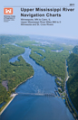
Click Here for Upper Mississippi River Charts. Printable page by page in .pdf format The Upper Mississippi River Navigation Charts cover the Upper Mississippi River from the head of navigation at river mile 866 in Minneapolis, Minn., to the confluence with the Ohio River at Cairo, Ill. The navigable portions of the Minnesota and St. Croix Rivers are also included. The charts were last updated in 2011.
Cairo, Illinois to the Gulf of Mexico. River Miles 953 to 0 at A.H.P.
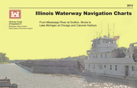
Click here for Illinois Waterway Charts. The Illinois Waterway Navigation Charts cover the Illinois Waterway from the confluence of the Illinois and Upper Mississippi Rivers to Lake Michigan at Chicago and Calumet Harbors. The charts have been updated in 2013.
If you enjoy reading about the New Madrid Earthquakes of 1811-12 in Volume 3 of DISCOVER! America’s Great River Road,you will enjoy this interactive map of tremors around the US on a moment by moment basis!
TODAY’s Earthquake Fact: The Mid-Atlantic Ridge appears above sea-level at Iceland. This offers scientists a natural laboratory for studying on land the processes also occurring along the submerged parts of a spreading ridge. Iceland is splitting along the spreading center between the North American and Eurasian Plates, as North America moves westward relative to Eurasia.
Today in Earthquake History
August 30, 1986
M 6.9, Romania – Damage (VIII) in the Focsani-Birlad area, including the collapse of a church. Felt (VII) at Bucharest. Two people killed, 558 injured,… Read More
OK, as happens almost every year, folks are starting to call about flood conditions along the Upper Mississippi River. Especially with 4th of July holiday around the bend! The image here shows Riverside Park in La Crosse, WI. Basically, the river is plum full and about to start climbing onto the sidewalk. (Thank you Laura Smanski!)
I heard from Davenport, IA, that, yes the riverside has water creeping in, but scheduled events have simply been moved to Higher Ground. Since many campsites along the upper Mississippi River can be impacted by high water, you might want to make a phone call. If sites are available, your reserved site might be moved slightly to higher ground.
Boating of any type is more hazardous in high water. There is lots of debris, including whole trees, flowing by at a mighty quick pace. Canoes and kayaks are not recommended until the river is back to a 6′ stage, rather than the 13+- it is right now. Common Sense is King in high water. Highways, river towns, the Great River Road…not so much to worry about.
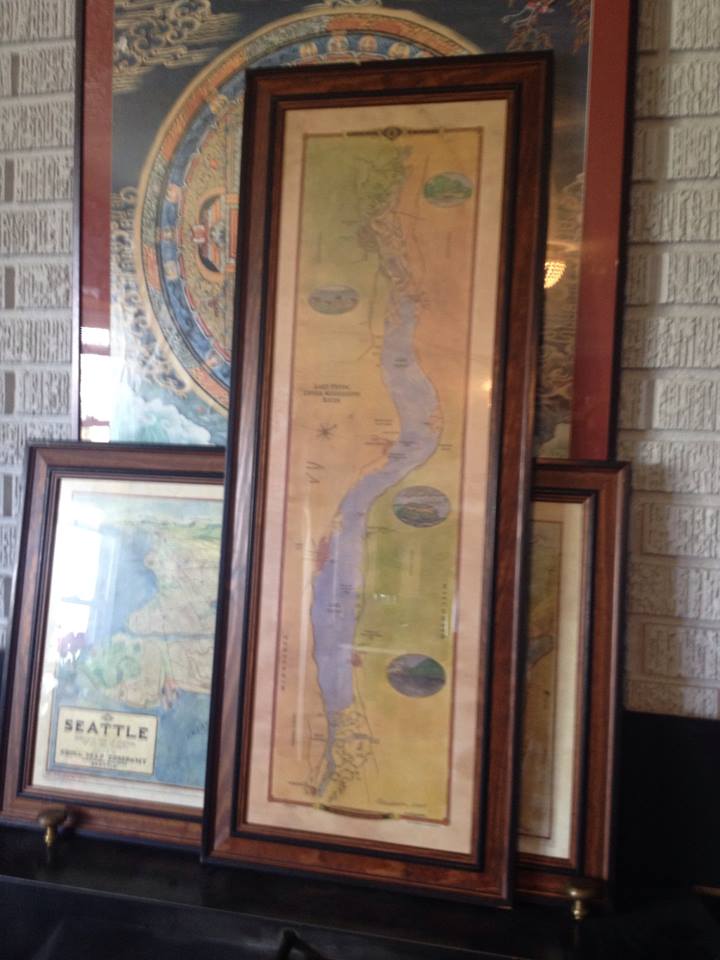
Our beautiful “New Map of Lake Pepin” drawn and illustrated by Wisconsin Map Artist, Lisa Middleton, is shown here framed. The gift prints are now available at better gift shops along both shores of the Upper Mississippi River for about $24.95. Or call us at 888-255-7726 to order!
The map, based on current USACE river charts is both historical and geographical in nature, with no commercial emphasis. The original painting and one full size giclee are available at Abode Gallery in Stockholm, Wisconsin. The original is close to 40″ long and 12″ wide. The gift prints which are a quality offset print product sized 11″x34″
Middleton also painted the 1887 Historic Reproduction of Glazier’s ribbon map, “The Father of Waters.” Gift prints of this map are also available at many fine gift shops along the river. Or call 888-255-7726 to order.
The largest steamboat in the world was recently purchased by The Great American Steamboat Company based in Memphis, Tenn., and it will return to America’s rivers next year.
The steamboat, which is 419 feet long and 90 feet high, holds 436 passengers was purchased for $15.5 million. It was launched in 1995 at a cost of over $65 million, but has been laid up in Beaumont, Texas since 2008, after the Majestic America Line decided to discontinue its cruise business.
“Our plans with it are to restore the service and return it back to its historical roots,” Greg Brown, executive vice-president of the Great American Steamboat Company, said.
“For two years we’ve been working on purchasing the American Queen, so this is the product of a couple years worth of work.” Brown said the American Queen will travel the “greatest hits routes” it used to travel, as well as some of the popular routes once traveled by the Mississippi and Delta Queens. He said itinerary for the American Queen will depend on the season, and it will travel the Mississippi River and many of its surrounding tributaries.
“We have it in the plans to get on the Ohio River for the Kentucky Derby season,” Brown said. “I think we’re a couple weeks away from having a firm schedule and brochure.”
Getting the American Queen up and running is expected to create more than 250 jobs, with 160 of those employees working on the steamboat at all times. Before starting out on cruises, Brown said the American Queen will undergo a $5 million renovation project. He said “she’s in very good condition,” but needs a new coat of paint, some machinery work, new dishes and bath towels, among other things.
Hurrah! for the Great American Steamboat Company. Hurrah! for America Rivers. 🙂
“Toots,” the original RIVERLORIAN for the Delta Queen Steamboat Company has written a memoir of the last cruise of the American Queen. Click link to visit.
I was amazed to read this a.m. of the tornado which destroyed the St. Louis International Airport as well as nearby neighborhoods late Friday night.
Visit www.weather.com for video and forcasts of continuing severe weather through the Easter weekend.
There is about 200% more moisture involved in this stalled front than is normal, which poses a real threat of continuing heavy rain for the next three days. This increases the threat of flooding on the Mississippi and other rivers through the Ohio River Valley.
I have been on the Mississippi River when rains in Kansas caused the Mississippi to raise 30 feet over night… we woke to a river full of floating logs, full sized trees, and other debris picked up by water raising in the back waters.
“Toots” Maloy, who for some 30+ years was the “face” of the Delta Queen and Mississippi Queen recently sent me her new memoir of her days on the paddlewheelers.
I found it doubly interesting because it was NOT a history of the company, but truly a memoir of her days on the boats, recounted as she made the last river journey of the Delta Queen to its current Tennessee berth.
Toots also serves as our eyes and ears as she gets a last look at the mold-infested shell of the Mississippi Queen. All of us who loved traveling the Delta Queen fleet, who loved traveling with Riverlorians “Toots”, Bill Wiemuth, and the rest of the crew, will find this a poignant reminder of how much has been lost with the cruising paddlewheelers.
“We haven’t just lost a vessel,” Toots writes, “we lost a way of life. And with just a stroke of a pen it could have been saved.”
Yes, we have Toot’s book available online at our Mississippi River bookstore. Just $7 plus shipping for a limited time. 54 pages, with 8 pages of photos.
Please click on the link below to order instantly online, or phone 888-255-7726.
A Page Out of History
by Riverlorian, Karen “Toots” Maloy
As of 2012, the AMERICAN QUEEN will be BACK on American rivers! Click link to see the update.
Starting to hear that two well-known cruise lines are preparing to offer river boat cruises on the Mississippi River next year!
Cruise West is renaming 100-passenger Spirit of Glacier Bay to Spirit of America and starting Mississippi cruises in 2011.
Most Mississippi cruises will go from New Orleans to Memphis or from Memphis to Nashville, with the first cruise being New Orleans to Memphis March 19, 2011. Other introductory cruises are in April and May.
Published fares: $3,499, $3,799, $4,299, and $5,099 per person double occupancy. Discounts may be as high as $600/person.
Cruise West suggests that the Spirit of America may also be found on the East Coast, the St. Lawrence Seaway, and the Great Lakes. We’ll keep you posted as we learn more.
Cooler weather means fishing is picking up on the upper river. Reports are starting to come in from the Genoa fishing barge. See our fishing reports at www.greatriver.com/fishing/fishreport.htm
This 35 pound catfish was caught on an ultra lite rod!

![IMG_1087+%25281%2529[1]](http://www.greatriver.com/wordpress/wp-content/uploads/2016/03/IMG_10872528125291.jpg)


 relatively large congregations of Egrets, Great Blue Herons, American White Pelicans. Small groups of Tundra Swans are filtering onto pool 8 and likely pool 7 already. Please comment as to where you are seeing swans.
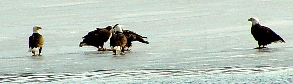
 We are pleased to offer several interactive maps on
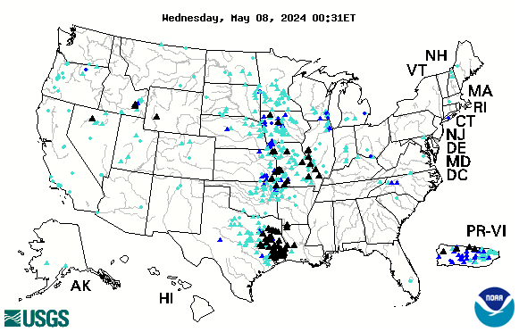

 Illinois and Upper Mississippi Rivers to Lake Michigan at Chicago and Calumet Harbors. The charts have been updated in 2013.
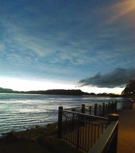

 I was amazed to read this a.m. of the tornado which destroyed the St. Louis International Airport as well as nearby neighborhoods late Friday night.


