Please click to comment! Links to the 10 BEST BETS Steveston BC Ferries Soames Point Half Moon Bay Gibsons Jervis Inlet (West Coast Wilderness Lodge) Skookumchuck Narrows Desolation Sound |
10 Best Bets for
Touring the Breathtakingly Beautiful Sunshine Coast of British Columbia,
Canada
Skookumchuck Narrows
|
|||
If You Go
Return to:
|
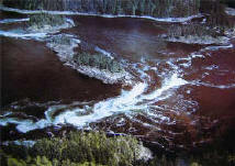
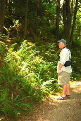
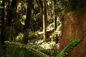
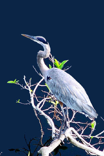
Skookumchuck Narrows Provincial Park The hiker passes through a cool, humid forest of giant Douglas fir, red cedar, and Western Hemlock. The shadowed undergrowth is crowded with huge ferns, and saplings drip with bright green goats beard (a northern cousin of Spanish moss). Stumps over 6-foot high and three-men-wide litter the forest floor. Brown Lake, one of hundreds of inland lakes that dot the coastline, tempts one to stop and lay in the thick soft undergrowth, but the real destination is the rocky overlook of Skookumchuck Narrows, one of one of the Sunshine Coast's most dramatic natural phenomenon.
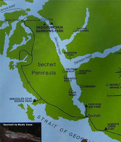
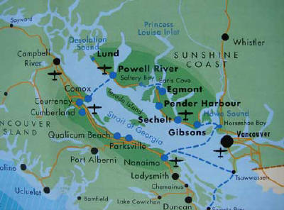
The violent Sechelt Rapids at Skookumchuck Narrows results from reversing tidal rapids famous for their spectacular whirlpools and whitewater and are considered among the fastest in the world. Current speeds during large tidal exchanges can exceed 16 knots (30 mph). Here, a narrow neck of the ocean known as Skookumchuck Narrows ("strong water" in Chinook jargon) connects Jervis Inlet and the strait of Georgia (see map of the Sechelt Penninsula) to land-locked Sechelt Inlet. Because of the restriction, the difference in water level from one side of the rapids to the other sometimes exceeds 2 metres!
Click small map to see a larger map of the Jervis Inlet and the Strait of Georgia Be sure to check for the daily tide with one of the tourism offices that are well-signed in each village along the coast. The tides vary widely in height, and your goal is to be there when the tide is highest. The area is unique in having two high tides every 24 hours. The day we were there was lower than normal.
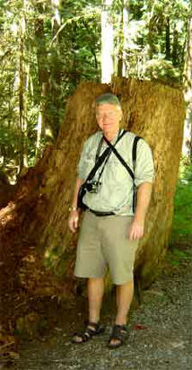
While Canadians are about the "hikingest" people we've ever met, and trailheads were numerous throughout our tour, our schedule meant we had few opportunities time-wise to hike into the vast forested mountains and forests all around us. Thus we very much enjoyed our 4 km trek through Skookumchuck Narrows Provincial Park. Recreational trails for back-packing 1-14 days abound throughout the Sunshine Coast.
Shadows under these grand trees are unnaturally deep, so when a tree has fallen and a ray of sun bursts in, it is a dramatic moment.
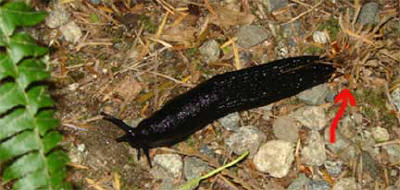
Note the cluster of
needle-like debris at the right side of this giant forest slug.... Ferns, giant slugs and hanging moss are all indicators of a rain-forest like environment. It's fun to discover this in such a northern locale. It could almost be Louisiana! On a similar note, a local mountain guide suggested that the vast northern boreal forest competes with the tropical rainforests for the title "lungs of the earth." I hadn't heard that claim before.
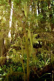
This northern cousin of Spanish Moss (photo right) is not a parasite. The forests are cool and humid enough that the moss can extract nutrients dust particles and moisture in the air.
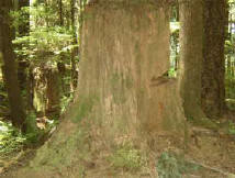
Loggers in the 1920s couldn't be bothered with the slightest imperfections in the lumber, so these giants were often cut six or more feet above the foot of the tree. The loggers made cuts in the logs for "springboards" to stand on so they could saw the tree above the point where the tree became perfectly straight and tall. The stump in photo, left, clearly shows the springboard notch.
Directions to Skookumchuck Narrows Provincial Park from Hwy 101 Follow Highway 101 north, past Garden Bay and the Pender Harbour area and take Egmont Road. To reach Sechelt Rapids at the Skookumchuck Narrows you will need to walk an easy 4 km trail past Brown Lake. The opportunity to walk among ancient stumps and old growth cedars was a high point of our trip. The day we visited, the tide at the Narrows was at a relatively low point so the walk was great. Be sure to carry water with you on the hike (and all hikes).
CONTINUE from Earls Cover Ferry Terminal to Saltery Bay, Powell River, Lund and Desolation Sound
Map of the Sunshine Coast of
British Columbia
Return to: Waterway Cruises Directory OR www.greatriver.com
|
|||


