OK, I love spring because one day (like today) there is a great sense of expectancy… the sun throws long morning shadows, a new bird arrives with every glance out the window (just saw my first starling), they sing in the morning with greater stridency, and the weather is just plain unpredictable.
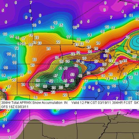
Well, according to Paul Douglas’s weather blog in Minneapolis, another 12″ snowstorm is predicted for the Tri-State area late next week. Here’s the graphic. Paul’s interpretation follows.
Paul Douglas writes: “Unlike Anything I’ve Ever Seen. This printout is a prediction for total accumulated snowfall between now and midnight, March 19, 2011. Two separate (major) storms: next Wednesday, another very significant snowstorm possible around March 18-19. The GFS prints out a 53″ bullseye over southwestern Minnesota (Windom area), with nearly 30″ for the Twin Cities between these two storms. Good grief. I pray the models are wrong – but I suspect they’re on the right track. I don’t have to tell you what this would mean for our flood potential come April.”
Paul continues, “The models have been surprisingly consistent in printing out over 1″ of liquid precipitation the middle of next week. If the storm tracks across southern Iowa into northern Illinois or southern Wisconsin heavy snow bands may set up directly over southern and central Minnesota and much of northern/western Wisconsin. There is a potential for a foot of heavy, wet snow from this storm. Nothing is guaranteed (except sunrise/sunset), so enjoy the relative peace and tranquility. We’ll probably make up for it next week.”

