The Vinland Map

In 1957 this map surfaced in rare map circles, and offered anonymously for sale to the British Museum.  Significantly it included an accurate depiction of Canada, the storied Vinland of the Icelandic Sagas.

The map predated Columbus by 50 years and a Viking map had never surfaced prior to this time.

The map was purchased for $300,000 and donated to Yale’s Rare Book and Manuscript Library.

In 1974 it’s authenticity was questioned due to a modern chemical used in the ink.

The question remains to this day: was this a Viking map?

Watch this video for yourself and leave your responses below.

I would personally LOVE for this to be a Viking Map!  I would love to imagine a library of information destroyed by the Vikings themselves or buried at sea with the Viking kings, their secret oceanic pathways taken with them to Valhalla.

March at Last! And a special offer on our beautiful IRELAND 1906!


Until March 18!! SALE! 25% off!
Our Ireland 1906, hand-painted by Lisa Middleton

This is a beautiful historic map of all the major rivers and cities in Ireland circa 1906 by one of my favorite cartographers, John Bartholomew of Edinburgh.
11×14″ Gift Print, 18×24 Giclee, and 24×36 Giclee 25% until March 18!
Please visit this Etsy listing to order the 11×14″ gift print
Here to order the 18×24″-Choose Ireland on the drop down list
Here to order 24×36″-Choose Ireland on the drop down list
Use coupon code IRELANDSALE at checkout.

We also have one 24×36 ORIGINAL FRAMED Ireland map in stock.  Please call Pat at Great River Publishing 1-888-255-7726 for information or email her here.

Please click here for an in introduction to John Bartholomew!

Newest work


Plan of New Orleans The Capital of Louisiana; with the Disposition of its Quarters and Canals as they have been traced by Mr. de la Tour in the year 1720 . . .

Description:

This early English plan of New Orleans was drawn by Thomas Jefferys, one of London’s top map makers during the period prior to the American Revolution.

The map shows a detailed plan of New Orleans, at the start of the French & Indian War, providing a detailed overview of the town, including street names, building locations and the names of important public locations, civilian and military, with a inset key of other place names in the upper left corner.  The four major roads into New Orleans are also shown, along with a detailed study of the Mississippi River in 2 insets on the right side of the map.   Following the Treaty of Paris in 1763, New Orleans would become one of 2 French Outposts in North America, after the French conceded their rights to all of their North American colonial possessions, except New Orleans and two important islands for retention of fishing rights in the Grand Banks.

Jefferys’ finely executed map is one of the earliest obtainable maps of city of New Orleans itself, founded in 1717 by the Sieur d’Iberville. As noted in the title of the map, it is largely based on the original manuscript plan of the city drafted by Pierre Le Blond de la Tour in 1722, and draws also upon Bellin’s plan of 1744, which had first appeared in Charlevoix. 

The outlines of the buildings are detailed, and major structures are labeled, such as the “Parish Church” of St. Louis, the monastery of the “Capuchin-Fryars”, the ‘House of the Indendant”, and the “Hospital and Convent of the Ursulines,” the latter being the oldest building in the city that survives to this day.

In Charting Louisiana, Magill states that Jefferys’ map includes several interesting and important details that Mr. de la Tour’s map lacked or were constructed after his manuscript was constructed, having primarily to do with flood control, which had been an important problem for the French from the initial years of the City.  

On the banks of the Mississippi, Jefferys notes a “Bank to preserve the Town from the Inudation.”  Just beyond this are moats created in 1729. The map also shows gutters and footbridges, as well as buildings built after 1721.

The map appeared in The natural and civil history of the French dominions in North and South America. Giving a particular account of the climate, soil, minerals, animals, vegetables, manufactures, trade, commerce, and languages … Illustrated by maps and plans of the principal places, collected from the best authorities, and engraved by T. Jefferys, Geographer to his Royal Highness the Prince of Wales. Part I. Containing a description of Canada and Louisiana. London, Printed for Thomas Jefferys at Charing-CrosMap Maker: Thomas JefferysPlace / Date: London / 1759, Original Coloring: Uncolored, Original Size: 20 x 14 inches
Estimated Price for an original map in 2013: $2,400.00  Lisa’s Painting is based on a specific print obtained from the Library of Congress. http://www.wdl.org/en/item/9558/

Additional Information

·  New Orleans was founded in 1718 by Jean Baptiste le Moyne, Sieur de Bienville, governor of the French colony of Louisiana. Bienville named the town after Philippe, Duke of Orléans, regent for King Louis XV. This map, published in London in 1759 by Thomas Jefferys, displays the focus and symmetry of the town plan, which was designed by or under the direction of Bienville. The “Mr. de la Tour” in the title refers to one of the earliest detailed manuscript plans of the city and denotes Pierre Le Blond de la Tour (circa 1670–1723), a Frenchman who was the chief royal engineer in Louisiana. Important places, such as the house of the intendant, the jails and guard house, and the hospital and convent of the Ursulines, are marked on the legend. The Mississippi River is referred to by the French designation “River Saint Louis,” but the indigenous American name that ultimately would prevail also is given, spelled as both “Mississippi” and “Meshassepi.” The inset maps show the course of the Mississippi from Bayagoulas to the Gulf of Mexico, and the east mouth of the Mississippi with a plan of Fort Balise, the French bastion defending the entrance to the river. The “Bayagoulas” were Indians living near the present-day town of Bayou Goula, Louisiana, in Iberville Parish. Their name was derived from the Choctaw or Mobilian language meaning “bayou people.”


About the Artist


Lisa Middleton grew up exploring the Mississippi River Valley with her family. Many of her subjects are drawn from life experiences in Nepal, China, Haiti, the South Caribbean, her beloved Western Mountains, and the coulees of the Upper Mississippi River.  Lisa’s art has embellished book covers, CD covers, and Madison Avenue brochures. Visit www.greatriverarts.com to see all of her hand-painted map reproductions on line.


Art work is copyrighted by the Artist, 2013.

1-888-255-7726

s. MDCCLX.


Wine Guys Art Show 2013

We had a DELIGHTFUL experience at the Wine Guyz Oktoberfest map exhibition!  We were so engaged the night of the reception we have very few pictures.

Mom did a great job framing quite a few beauties for the show.  My family pitched in to hang the paintings, attend the reception, and take them all down.  What a loving family!  My thankfulness is inexpressible.

We re-distributed the maps that didn’t sell along the Mississippi River.  To see where they are now see below!  If you are interested in one please contact me or one of these fine establishments!

Please Like us on Facebook!

Please visit our website!

Please shop at our Etsy store!


 sold


 Sold


 Minnesota Maritime Art Museum– still for sale


Prescott Visitor Center, Prescott Wisconsin 


Abode Gallery, Stockholm Wisconsin


 Abode, Stockholm WI


 Minnesota Maritime Art Museum, Winona MN


Cruising the River…September 2013

I was so lucky to ride the riverboat with Mom for a few days!  What classy old-world luxury.  Thanks for showing me the ropes, Pat Middleton, and so much more!

Please Like Great River Arts on Facebook!

Please Visit our Website!

Please Shop in our Etsy Store!


 beautiful Tiffany stained glass at St. Luke’s in Dubuque Iowa

Mom and Bonnie from the Iowa Store in Dubuque Iowa…Great River’s customer for 20 years!


All the details of riverboat class


beautiful evenings on the river


a real autograph of Louis Tiffany


Front deck


 the boat has to take the steam stack down when going under low bridges.


 Dad and I enjoying the front porch


 another beautiful evening shot


 Mom gave presentations on the bow twice a day


 it was wonderful to meet famed riverboat painter Michael Blazer whose work adorns the boat.


 The American Queen is so beautiful!


 the paddlewheel is mesmerizing and relaxing


 the big steamboat outside Dubuque IA


 the Gentleman’s room aboard the boat


 I was so excited!


 one of the dinner rooms aboard


the presentation room- real old world style!


 the Mark Twain Room as you enter the boat


the welcoming committee in Burlington, IA


 Mom works hard on the boat but she sure loves it!


 Mom talking to an inquisitive guest


I’m SO proud to have my maps in the gift shop next to Mark Twain’s books!


 the Ladies quarters as you enter the boat.


 the Mark Twain room…all the details


 big bald eagle along the river


!


 Meet and Greet in the gift shop.


 I met riverboat painter Michael Blazer on board!


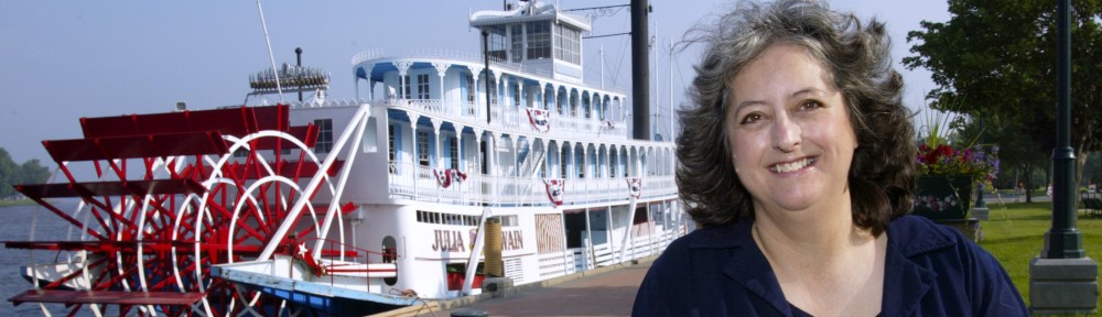
 Lisa and Dad saying goodby to Mom as she sailed away for another week on the boat.


 Me feeling myschevious at my last lunch on the boat with Mom.


Made in Montana Report: March 2013


Made in Montana Report: March 2013


I had a huge learning experience at my first wholesale tradeshow at the Made In Montana Marketplace in March 2013!  Luckily I had great traveling weather and I got to experience more of Montana’s exquisite early spring beauty.


A jeweler from Seeley Lake, MT offered to share a suite with me this year and turned out to be an excellent mentor.  I hope to keep in touch with her and room with her again next year!  She is a person dear to my heart and I like her art a lot.  She moved here from California and is an avid dogsled musher and has a hard time getting away from her 13 dogs!


This was her third year at Made in Montana Marketplace and she was invited to join the tour in Billings and Salt Lake City.


http://www.donamiller.com

http://www.sibernytedesigns.com


I hope to one day be invited to tour with the Made in Montana and I will let them know I’m interested.


I learned that I need emphasise my feature product, our 11×14″ gift prints.  I have so many products to offer (sizes, variations of maps, tea stained or not) that my product line is pretty confusing.  I will also put more energy into my notecards as these are popular and simple items for gift shops.


It wasn’t a bang up trip but it helped me get all my ducks in a row.  A souvenir company is interested in using my designs to distribute to their 1,000 retail locations.  I also did get a few new wholesale accounts with new orders coming in everyday.


I’m off to ship a few right now!


xo


Proud to offer: 1732 Cart De La Louisiane-French map of the NORTHWEST PASSAGE!

1732 Cart De La Louisiane by Delisle

We are so pleased to offer a beautifully painted version of the the 1732 Cart De La Louisiane Et Du Cours Du Mississippi by Delisle.

One of the original prints, seen below,  is sold for $3,000 on a map website. We are pleased to offer it for a price range between $3.50 (magnet size) to $285 for a 36″ version.

It is known to be one of the most important illustrations of North America ever published.  It was  one of the oldest maps consulted by Lewis and Clark when planning their expedition.

You’ll notice that the Missouri River Connects over the top of the Rocky Mountains, implying that it connects to the other side of the continent.  You’ll also notice “River De Norte” connecting from what appears to be Glacier National Park to the Golfe Du Mexique!!

This map is known for it’s accuracy on the eastern seaboard and up the Mississippi River Delta.  Why wouldn’t the hopeful explorers believe it when it represented another Mississippi River on the West side of the mountains?  They must have trusted the map because it was so accurate in some areas.  Today we see that it was just wishful thinking!

Up close you’ll also see the routes of earlier explorers dating from 1540.
This is one of our prized early maps.  Please keep checking back for more maps as we release our western collection, and a beautiful Lewis and Clark map.

You can purchase this map and others by calling 1888-255-7726
You can also visit our websites:
www.greatriver.com
www.greatriverarts.com

and our Facebook pages under Great River and Great River Arts