This Weekend at Adams Center March 22 and 23!
This Weekend at Adams Center March 22 and 23!
It started last summer.
Got a call for 2 overnight Giclees…
OH NO only 1 in stock…Had to disassemble a personal framed copy!
Then I discovered….the customer wanted them both abused, beat up and mangled! This required special attention! They were to be a prop in a MOVIE!
OUT came the coffee grinds! OUT came the steel wool!
I rubbed them in dirt, doused them with grime, creased them outside in, inside out, upside down. Soaked them, dried them, soaked soaked again.
I was so excited and I was happy to spend the rest of the evening manhandling them. Usually I handle the museum quality giclees with such tenderness…this felt like a violation! Abomination!
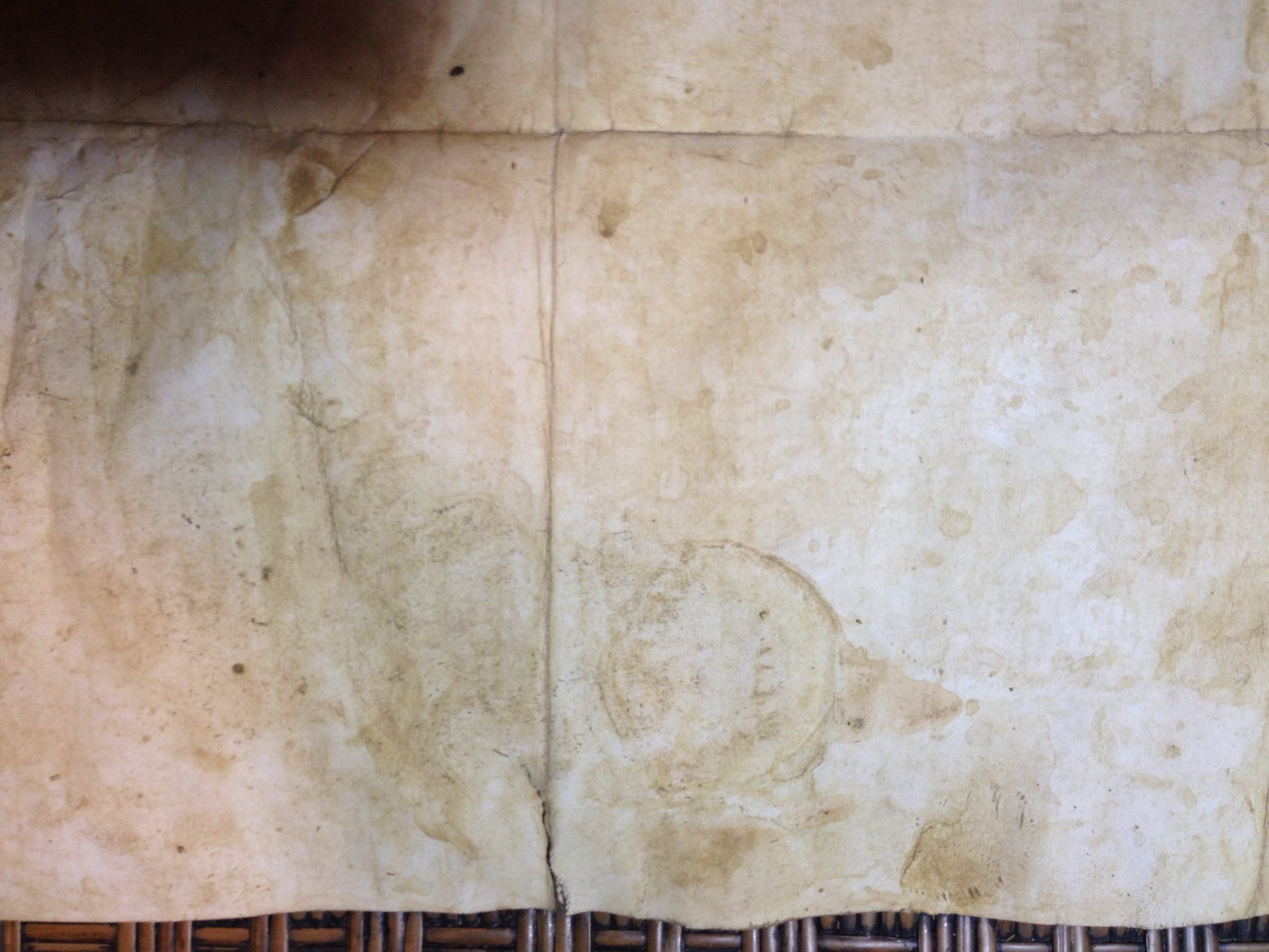

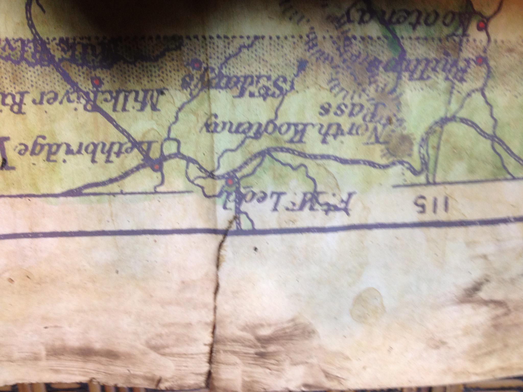

I woke up early the next morning and roughed them up some more and met the overnight deadline. Now months later I’m able to see the maps as props in the Music video! Great music by the way. You can see it here.

I’m so proud! I love the little surprises of being an artist and contributing to a larger story!


In 1957 this map surfaced in rare map circles, and offered anonymously for sale to the British Museum. Significantly it included an accurate depiction of Canada, the storied Vinland of the Icelandic Sagas.
The map predated Columbus by 50 years and a Viking map had never surfaced prior to this time.
The map was purchased for $300,000 and donated to Yale’s Rare Book and Manuscript Library.
In 1974 it’s authenticity was questioned due to a modern chemical used in the ink.
The question remains to this day: was this a Viking map?
Watch this video for yourself and leave your responses below.
I would personally LOVE for this to be a Viking Map! I would love to imagine a library of information destroyed by the Vikings themselves or buried at sea with the Viking kings, their secret oceanic pathways taken with them to Valhalla.
_by_Max_Br%C3%BCckner.jpg)

Until March 18!! SALE! 25% off!
Our Ireland 1906, hand-painted by Lisa Middleton

This is a beautiful historic map of all the major rivers and cities in Ireland circa 1906 by one of my favorite cartographers, John Bartholomew of Edinburgh.
11×14″ Gift Print, 18×24 Giclee, and 24×36 Giclee 25% until March 18!
Please visit this Etsy listing to order the 11×14″ gift print
Here to order the 18×24″-Choose Ireland on the drop down list
Here to order 24×36″-Choose Ireland on the drop down list
Use coupon code IRELANDSALE at checkout.
We also have one 24×36 ORIGINAL FRAMED Ireland map in stock. Please call Pat at Great River Publishing 1-888-255-7726 for information or email her here.
Please click here for an in introduction to John Bartholomew!