Historic River Maps make Great Gifts!

Historic River Maps Make Great Gifts!

Lisa's maps at village frameI walked into Village Custom Frame in La Crosse, WI, the other day and found Sue busy at work filling orders for Lisa Middleton’s historic map prints ordered for Christmas giving. The framed maps 1887 Ribbon Maps are a GREAT idea for a corner nitch, or between two windows, or as a cabin feature!

If you don’t live in La Crosse, Stockholm, Alma, Winona, or Wabasha … where many of the frame shops sell Lisa’s maps already framed… you can now order FRAMED 1887 Mississippi River Ribbon maps at the Great River Publishing gift shop on ETSY.com/shop/greatriverpublishing

frame samples

$145 includes choice of mat color (choose from those samples show) with a dark wooden frame in black or brown. Maps can be shipped directly to the recipient!

Questions? Ready to order? Have another of Lisa’s historic map paintings you’d like framed and shipped? Want to frame the original painting?

Please call!

1888-255-7726


The Joys of Being A Map Collector!

Oh the joys of being a map collector!

Maps illustrate both history and curiosity. Created over the centuries by people just like you and me, maps describe the world as they understood it, doing the best with the light they had to see by. When I see dear old maps-misconstrued proportions and sea monsters-I want to pinch the cheeks of our early relatives and say “you are so darn cute!”

If there is one thing I’ve learned from these dear old maps is that future generations will benefit from our explorations.

Each of us have a unique way of traveling into the unknown…where “there be dragons” of our own.

This holiday season I hope you are able to cherish every moment with your loved ones. It’s a gift in itself to be able to take moment for those in our lives that help us on our sojourn.

Best wishes!

Framed Father of Water Maps!

Drumroll please….
Framed Father of Water Maps!

We are tickled to offer our best seller The Father of Waters 1887 in a beautiful matted and framed version for $145! 
Please visit my Etsy Page to place your order.
Frames are available in a dark brown (pictured) or black, with a choice of 4 matte colors.
Outside dimensions are 8.75×42″.
We’ve sold over 5,000 Father of Waters maps and countless others have been sold with frames!
Framed in Holmen, Wisconsin. This offer will be available until Dec 12.


Please visit my Etsy Page to place your order.

S. Augustus Mitchell -Reuniting artistry to Atlases in the late 1800’s

S. Augustus Mitchell

Reuniting artistry to Atlases in the late 1800’s

A teacher turned cartographer, Samuel Augustus Mitchell, a Connecticut native, decided that it was time for somebody to do something. Frustrated at the lack of quality resources available to teachers of geography, he uprooted himself and moved to Philadelphia where he founded his map making company after his frustration grew into action. He purchased engravings from the New American Atlas by Anthony Finley in the year 1826. as a basis for his new venture.  Augustus then hired Finley’s best engraver, Jay. H. Young to update and improve the printing plates. The goal was to keep them current since America was growing extremely fast during the early 1900s.

Augustus also found the appearance of the maps to be quite lackluster so he began to add decorative floral borders to them in what would later become known as his signature touch. In 1831 his first work was published, Mitchell’s New American Atlas. From there, he and Young produced several maps together as well as a guide for travelers. His next atlas would be produced after buying the copyrights and copper plates for Tanner’s New Universal Atlas. The purchase price at the time was a hefty $10,000.

Yet his purchase would prove to be genius later on. Rather than using the copper plates for printing, which would actually destroy them after very little use, he had the images preserved forever on lithographic stones. Once they were carefully transferred, they were virtually indestructible and would be used for just the remainder of his map making career.

As stated earlier, Mitchell Senior was known for his prolific use of floral borders. They are colorful and extremely decorative in nature. However, you will notice the borders changing if you view a Mitchell map from the late 1850s as most of the copyrights were acquired by Desilver and Company. They continued to publish many of his maps with modified colors schemes and borders.

Yet, Once Mitchell Junior took over in 1860, the style again became much more congruent with that of his father. Ironically, S Mitchell Junior became just as prominent as his father. He continued publishing maps well into the late 1880s until copyrights were once again sold and the Mitchell’s exited the map making business altogether.  Their original works are sought after today as a piece of American History and Nostalgia.

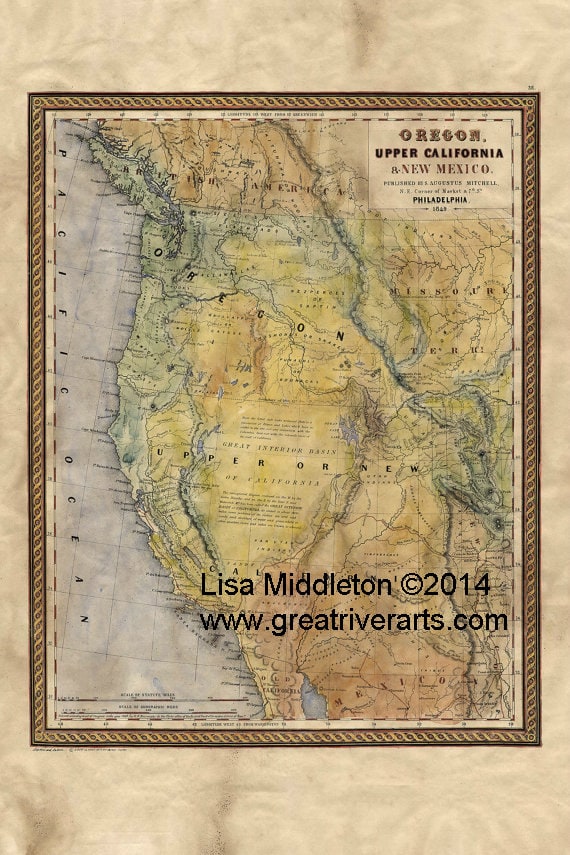
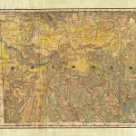
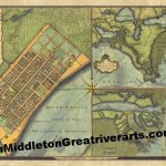
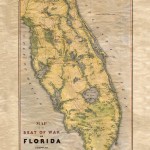
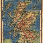
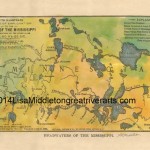
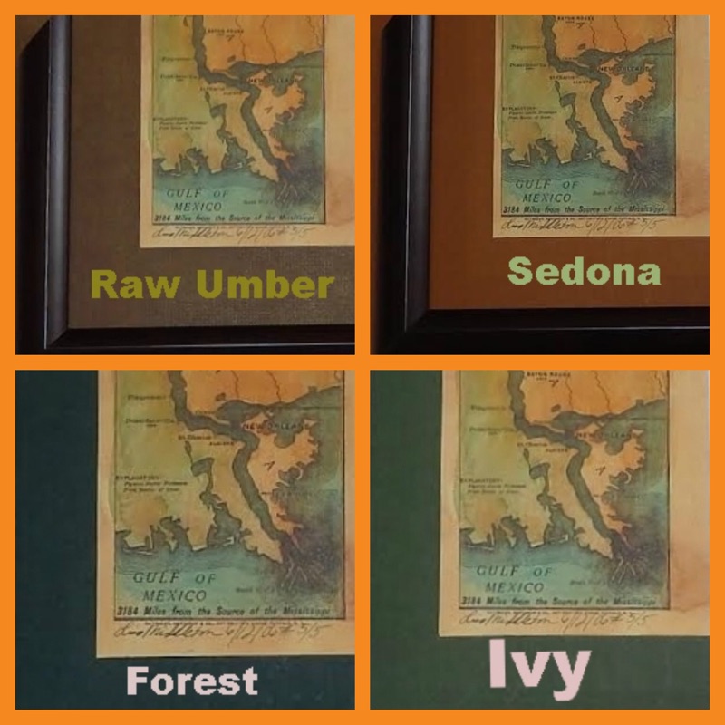
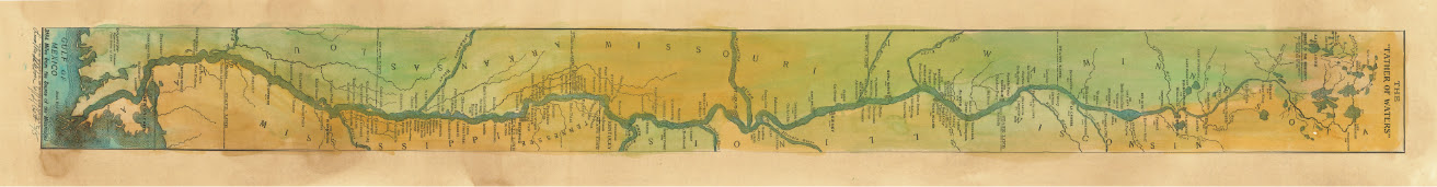
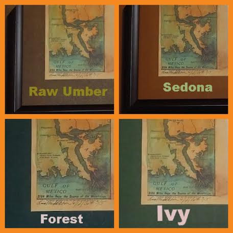
You can see how Mitchell is effecting my work in these images….There’s more to come! I promise.

https://www.etsy.com/listing/203176218/1849-map-of-oregon-upper-california-and?

1849 Map of Oregon, upper California and New Mexico-Mitchell 11x14 UV resistant laser reproduction, signed and numbered.