MISSISSIPPI RIVER HOME | WATERWAY CRUISE REPORTS |
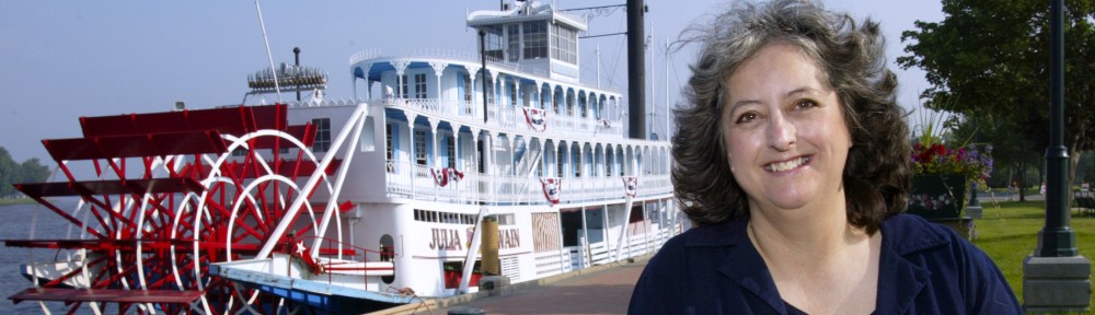
Author’s note: I met Captain Lawrence while he was piloting the Mississippi Queen; for most of his career he has been a towboat pilot. He shared with me some of his thoughts about the river and those of us who use and enjoy it. © Pat Middleton, “Discover! America’s Great River Road, Vol 2.”
“There are no two rivers that are alike. The piloting is unique to each, as is the scenery and the history. This is purely the Mississippi River. It doesn’t compare in any way to any other river.
The people living ashore are so interesting. They love their river, their boats, the fish, the recreation. They feel so much ownership of the river and its valleys. Those of us who work on the river feel this appreciation, too; a strong sense that this river belongs to all of us. We have to make room for one another and all our varied interests. It’s vital to protect this river, its wildlife.
I think it’s hard for people to even imagine the vast importance of the river in the lives of millions of people in this great nation, and all those foreign countries that depend on our foreign trade. Electric plants, drinking water, fuel, and grain are supplied by or moved upon this river.
Mark Twain would be astonished at the power, the scope of river traffic today when compared to the paddlewheelers that ran the river in his day; the sheer power of the diesel towboats, the steel hulls that have replaced the wooden hulls. The steamboat pilots really were the pioneers of river transportation as we know it today.
I’ve seen the Locks on the upper river put in place. I’ve seen the corn business explode because of the navigational technology that allows us to move the corn. Improvements in agriculture and shipping have developed hand-in-hand.
One barge with a nine-foot draft can move 1500 tons of corn. The freight pushed by a single towboat and its crew of
eleven men is worth many millions of dollars and moves as much grain as a twenty train engineers, twenty firemen and twenty brakemen, etc. If something should happen to the lock system, it would cripple the american econonmy. Trucks and trains or airplanes could not possibly make up the difference.
The main thing a Midwestern farmer thinks about is getting his harvest of grain to the elevator. But that’s just the beginning. There is more corn produced in the upper Midwest than anywhere else in the world. More grain is moved on the Mississippi River than on any other river system in the world. The sight of ocean-going barges from around the world picking up Midwestern grain in New Orleans is sobering. Few farmers begin to realize the number of people around the world that are fed by Midwestern corn.
The Indians called this the “Father of Waters” and that’s exactly what it is today. I’m a long run pilot. I just know what I see on the river. ”
© Great River Publishing
Stoddard, WI 54658-9801
All Text and Images are copyrighted by the authors and photographers. All Rights Reserved. To request permission to reproduce content in any format, please phone 608-457-2734 ..


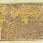
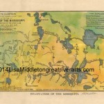
 e Missouri River, flowing east and then south for thousands of miles is North America’s longest river. It is a gem of natural resources and a vital transportation pathway. Nicknamed the “Big Muddy” and “Dark River” because of its silt material, the river begins at the confluence of the Madison and Jefferson Rivers in the Rocky Mountains of western Montana. The river flows across eastern Montana, then continues through the center of the Dakotas on its southern trek, before becoming the state line between Nebraska and Iowa, then dividing Kansas from Missouri. The Missouri travels east again across the upper part of the state that carries its name before entering the Mississippi River just north of St. Louis.The Missouri River valley was the home of several Native American tribes around 1500, including the Mandan, Arikara, Missouria, Lakota, Hidatsa, and Otoe, among others. French explorers Louis Jolliet and Jacques Marquette, in 1673, were the first Europeans to see the Missouri River. However, it was the Lewis and Clark Expedition (1804-1806) that produced the most promise and paved the way for the Missouri River to define the American Frontier. The discovery of a navigable Missouri River route made possible the growth of the fur trade in the early 1800s. Fur trappers in the upper Missouri River basin bartered iron, brass, knife, blankets, cloth, metal, firearms, metal containers, and even alcohol with Indians, for beaver pelts and the hides of bison and buffalo.The function of the Missouri River has changed over time, and today, tourism and recreation are the two key features of the river. Kayaking, canoeing, bird watching, camping, fishing, and hiking are some of the activities that can be enjoyed on or along the river. The Lewis and Clark National Historic Trail, which crosses eleven U.S. states and retraces the course of Louis and Clark Expedition, is a feature attraction along the Missouri River. Still, the Missouri River flows through or past many National Historic Landmarks including the Big Hidatsa Village Site in North Dakota, and Montana’s Fort Benton, among others. There is plenty to explore and enjoy!