
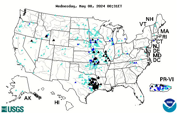
Much of the central part of the country, along with the Lower Mississippi, is currently experiencing dangerous high water. See up to the minute status reports for American rivers by clicking on our INTERACTIVE FLOOD MAP. Black triangles indicate serious flooding.
Related categories are highlighted above this story. Click on a category above to see more stories from our massive archive!
This map is interactive and constantly updated by the USGS.
Looking for more great content, lots of river content available by clicking on any of the category links shown below the comments!