
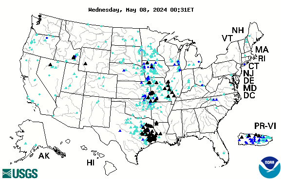
Below is the USGS interactive map that provides REAL TIME info on which Rivers in the US are cresting. The map below is accurate every day. Black Triangles indicate flood stage. Looking to compare stats with the Flood of 1993? CLICK HERE.
See more interactive maps by clicking the category in the list to right: INTERACTIVE MAPS