
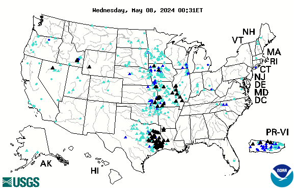
The Mississippi River crested last week just over flood stage at around 16.3 feet at Prairie du Chien. The river dropped to about 13.5 feet this week and is forecast to steadily decline to around 12 feet by this upcoming weekend.
The Wisconsin Journal has reported the following park openings as milder weather allows for needed repairs:
Both campground at Devil’s Lake State Park in Baraboo and the Elroy-Sparta State Bike Trail have been reopened. Wildcat Mountain State Park is scheduled to reopen July 3.
While the park and campgrounds at Devil’s Lake are open to visitors, a number of trails and facilities will remain closed due to flooding and storm damage, including both the North and South Shore boat landings; most hiking trails; portions of picnic areas; and the South Shore bathrooms. Portable toilets will be available for visitors using the South Shore picnic area. The park’s beach is underwater, but it has tested as safe, and swimming will be allowed. Most hiking trails are closed.
The 400 State BIKE Trail and portions of the Military Ridge State Trail remain closed. Military Ridge is closed in two locations because of standing water under the second box culvert approximately 2 miles west of Verona and approximately one-half mile east of Klevenville on a section of blacktopped trail.
Check the State Parks current conditions page of the DNR Web site for more information.
The Lower Wisconsin River has dropped considerably in the past week and is approaching near normal seasonal flows. Some sandbars are returning but people considering any paddling this weekend need to be aware there is much more debris and more contaminants in the river than normal due to the flooding. The Kickapoo River has also dropped considerably, but is still well above seasonal normal flows.
Rain amounts in the north have finally filled many lakes for the first time in a number of years, although some lakes are still considerably below normal water levels. Northern river systems like the Flambeau and Chippewa are currently at good seasonal levels for paddling.
Though the Wisconsin River has dropped back down to a normal flow level, Lower Wisconsin and Wisconsin River users are staying away due to DNR warnings of contaminated water. All of the streams in Southwestern Wisconsin have been affected by the flooding, causing wide and braided channels.
The floods have scoured silt-laden places and deposited sediment and rock in other. Streams that have been constricted by bridges and culverts have completely blown out or have created large pools downstream. Be aware that in many areas banks have eroded and may give way underfoot. Strong currents in rivers and streams pose an additional threat.
Fishing on the Mississippi River has been getting better as the water recedes, with channel catfish moving to find nests and being very catchable. Fishing for sauger and walleye also picked up a little late in the week.
While rains have diminished and floodwaters are receding, along with the damage they’ve left in their aftermath, mosquitoes are out in hoards, so don’t forget the bug repellant when venturing out this week.
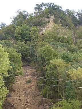 I recently ran across a number of stats presented by area scientists regarding the massive rains along the Upper Mississippi River last August. These rains produced unprecedented landslides in bluff country that resulted in seven deaths and several homes on both sides of the river sliding down onto the roads.
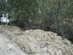 The bluffs of the “Driftless” region that stretches along the Mississippi River are formed of limestone bedrock covered by an ancient mix of clay and river silt. Under most conditions this is provides a solid base for home building, though most counties restrict building to a slope of 20-30%. Homes that are built on “benches” may have much steeper areas above them (or below). Between 1998 and 2006, 205 homes and 10 condominiums were built in La Crosse County on slopes with between 20% and 30% slopes.
