Sunny days, green bluffs and sparkling Mississippi River remind us that fun and socially responsible activities are all around us…and not limited just to our beautiful parks!! The Great River Road offers easily accessible scenic overlooks, fishing spots, historic side routes to tiny towns with big stories to share, and a fabulous opportunities for watching large wildlife. Eagles, Sandhill Cranes, Egrets, herons, pelicans, and Trumpeter swans are not hard to spot on a day’s drive. Take a picnic lunch and a copy of the nearest Volume of DISCOVER! AMERICA’s GREAT RIVER ROAD and make each day memorable!!
Check out all our Mississippi River products online at www.greatriverarts.com Are you a Kindle reader? Yes! Books are also available online at Amazon’s Kindle books and in regional gift shops along the river.
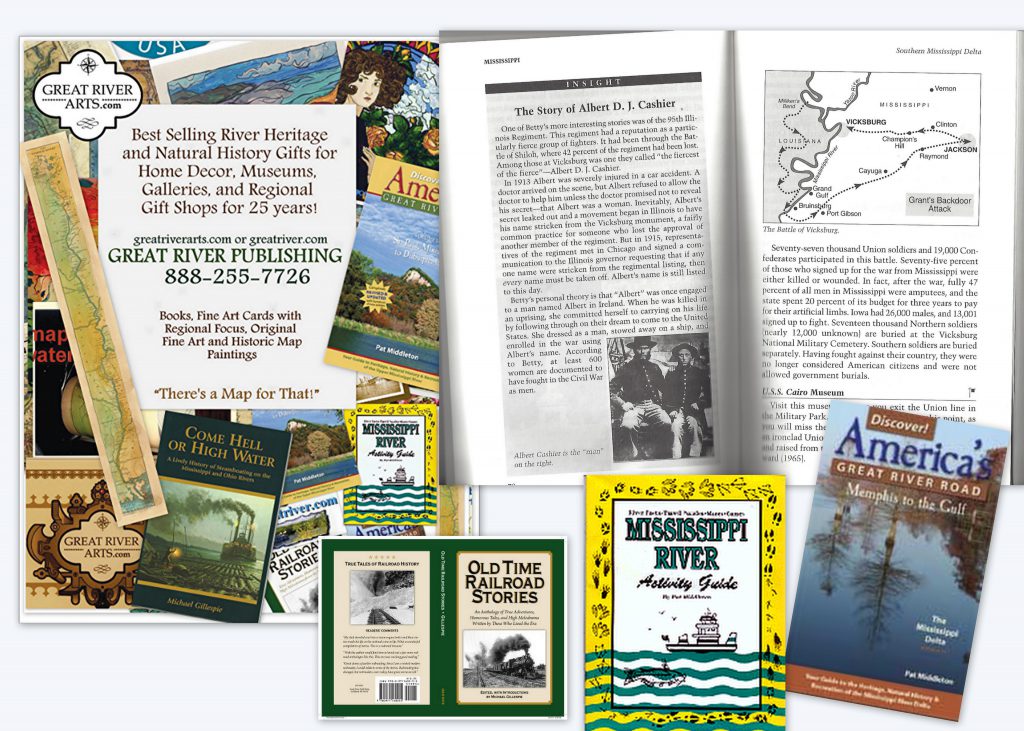
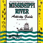
at Middleton and Great River Publishing have provided fascinating detail on life along the Mississippi River since 1987! TheMississippi River Activity Guide for Kids will provide summer structure for the elementary aged kids. In Volumes 1 (Upper), 2 (Middle), 3 Lower, 4 (Delta) of Discover! America’s Great River Road, Pat becomes your “friend on the road” providing in-depth background on everything you see along the Mississippi River. Father’s Day is a great time to gift your Dad a fascinating regional book or an historic map he will REALLY LOVE. Check out all our Mississippi River products online at www.greatriverarts.com
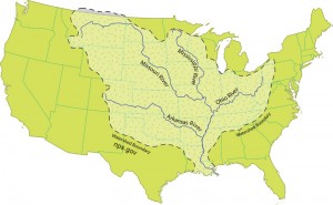
For Jack, who wants to know more about all the tributaries of the Mississippi River: how many there are, their names, and how long they are!
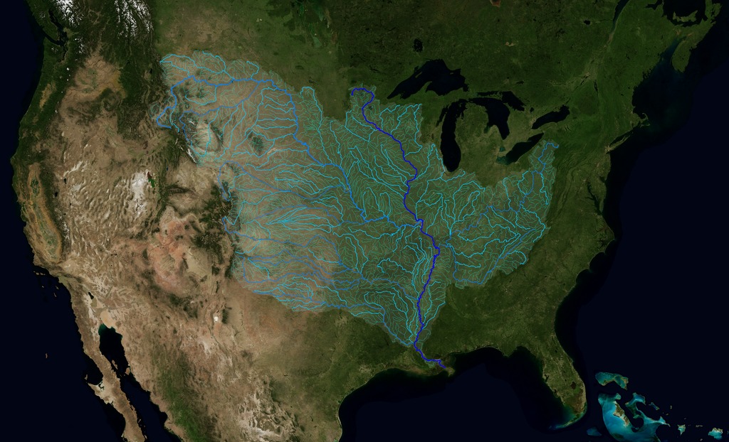
There are some 250 tributaries of the Mississippi which drain a total area of more than 1,247,000 square miles–one third of the nation’s landmass–extending from the Allegheny Mountains in the east to the Rocky Mountains in the west!
We start here with quick facts on the Mississippi River and several navigable tributaries! Please follow links for a little more depth of historical interest and to see our collection of hand-painted maps!
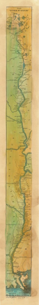
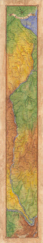
The Mississippi River, from its source at Lake Itasca in Minnesota, to the Gulf of Mexico, is approximately 2,348 miles long. The combined reach of the Missouri-Mississippi Rivers is 3,741 miles–a length exceeded only by the Amazon and Nile rivers. The Mississippi River has shortened by several hundred miles since the days of Mark Twain. Even today it varies 30-50 miles each year.
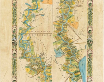
The widest navigable part of the Mississippi is Lake Pepin, on the Upper Mississippi, where it is approximately 2 miles wide. The average current flows from 1.2 miles per hour nearer Lake Itasca, and about 3 mi per hour nearer New Orleans. Our historic Mississippi River Ribbon Map has been a best-selling Gift for many years.
“This is a beautiful map!! My whole life is on this map! My home town, the towns where my kids live, even New Orleans, my favorite place to vacation!”
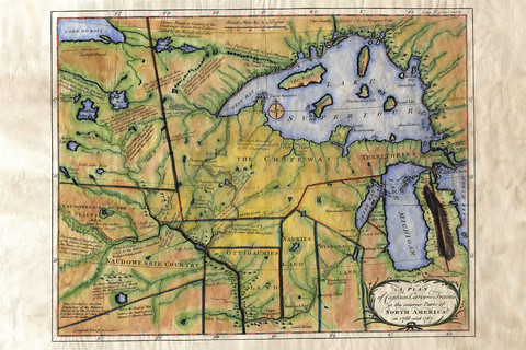
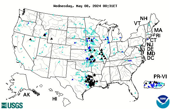
TRIBUTARIES OF THE MISSISSIPPI River … Watershed map U.S. Geological Survey EROS Center
Remember the great Mississippi River Flood of 1993? It wasn’t just the Mississippi River flooding that wreaked havoc, it was that all those tributaries flooded as well! At one point, the volume of water flowing past St. Louis was eleven times the volume of Niagara Falls!! You may also want to check out our interactive map of which of the tributaries are at flood stage today! Click INTERACTIVE MAPS in the category list, right hand column, to see where the tributaries are at flood level TODAY!!
Lisa now offers her own custom ribbon map designs of both the OHIO RIVER and the Missouri River. Please click on any map image for more info on the map or the tributary. Or PHONE 888-255-7726 to order any map. Click on map images for more info on the tributaries.
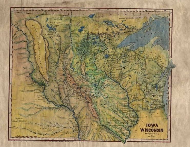
THE MISSOURI RIVER is considered to be the longest stream of river in the US . The Missouri River which begins at Three Forks, Montana (elevation 4,032 feet) and flows 2,714 miles to near St. Louis, Missouri. Many people consider the Missouri to be the main reach of the Mississippi River!
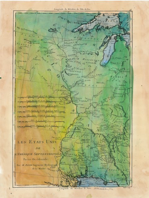
The Arkansas River forms in the Rocky Mountains in Colorado and meanders 1,450 miles through Kansas, Oklahoma, and Arkansas. It is the main water source for the state of Arkansas.Click here to see more Arkansas River facts and Artisan Maps by Lisa Midd
/
The Ohio River is the second major tributary of the Mississippi. It is formed in Pittsburgh by the junction of the Allegheny and Monongahela River and travels about 980 miles to Cairo, Illinois, and the Mississippi River. Interestingly, today’s Ohio River Basin is approximately the northern extremity of the ancient shallow sea that is represented today by the Gulf of Mexico! Consider that nearly 1/3 of the nation’s water drains past the confluence of the Ohio and Mississippi rivers at Fort Defiance in Cairo, Illinois!
The Illinois River, cutting through steep rocky bluffs, runs approximately 273 miles (439 km), with some 60 miles of scenic water. It flows through the heart of the State of Illinois, and links the great rivers of the American West with the Great Lakes, the St. Lawrence Seaway, and finally the Atlantic Ocean.
Historically, the Illinois River has had a significant impact on the state’s economy, communities, and peoples. Long before Europeans discovered America, indigenous tribes inhabited the Illinois River Valley and settled on the riverbanks, creating a river culture of their own. In 1673, Father Jacques Marquette and Louis Joliet surveyed the region, canoeing up to the Illinois River via the Mississippi River, hoping to find a route linking the Great Lakes to the Illinois River and the Gulf of Mexico. Today, the Illinois and Michigan Canals are the evidence that their vision became reality.
And for fun, checkout our fascinating 1841 STEAMBOAT MAP OF ILLINOIS lists all the steamboat stops and distances along the Illinois River and the Mississippi, Ohio and Vermillion Rivers!
Wonderful detail!
Planning for an upcoming CRUISE? We’ve featured several of our SMALL BOAT CRUISE destinations here! WATERWAY CRUISE REPORTS
A note from map artist, Lisa Middleton Friends,we are all charting the course day by day in this confusing time. It seems if we miss the news a single day, everything changes the next, and the world is upside down. Kudos to all of you who are staying home to save lives! My sincerest regards to those who are personally affected by COVID-19. Thank you to those in essential industries who keep the world turning at times like this.
Maps represent our human experiences, memories, and a thousand little stories of the ancestors who beat impossible odds to create the historical maps we hold in our hands today. Our current circumstances are no less difficult, and we can chart the course together, day by day.
Our maps are unique in the industry! You may have loved ones who had to cancel their vacation, or know of a young couple who had to cancel their wedding or honeymoon. Maybe there is a grandparent in your life who has to be alone in quarantine thousands of miles away from you. There is no better way to tell them you care than to send them a map of a memory, a family legacy or even their dream!
“In her hands, a torn black-and-white 1883 plat of Montana Territory blossoms into a vividly colored snapshot of what the land once was. It remains a map by definition, but by execution it is now an ornate showpiece fit for the living room wall, touched by an artist’s hand with its essential purpose still intact.” Myers Reese, Montana Quarterly Fall, 2014
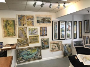
We invite you to browse our galleries of more than 400 antique, Mississippi River, East Coast, West Coast, and original custom designed map art at Great River Arts…. greatriverarts.com !! Enter a key word in the orange SEARCH BOX at the top of the map page to explore the cartographer, the year, region or title that is meaningful to you. We hope you enjoy this gift of art and history!!
Much of the central part of the country, along with the Lower Mississippi, is currently experiencing dangerous high water. See up to the minute status reports for American rivers by clicking on our INTERACTIVE FLOOD MAP. Black triangles indicate serious flooding.
Related categories are highlighted above this story. Click on a category above to see more stories from our massive archive!
This map is interactive and constantly updated by the USGS.
Looking for more great content, lots of river content available by clicking on any of the category links shown below the comments!
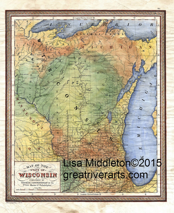
Our Historic Map Collection is Growing by Leaps and Bounds! More than 350 hand painted Historic, Retro, and Custom Designed Maps are now available, many on our Mississippi River-focused Great River Shopping Cart !
Our 1887 Mississippi River Historic Ribbon Map can now be artisan matted, framed and shipped nation-wide for $220. Need a custom map of YOUR estate or favorite destination? Please PHONE 888-255-7726 Hand painted originals available now!Usual wait period is 1 month! So order now for a gift to be available by Christmas. Four matting choices!
CLICK HERE TO SEARCH our Map shopping site by any KEYWORD… date, cartographer, locale, state, etc. If you don’t find it, Call us! 888-255-7726
Much of the central part of the country is currently experiencing dangerous flash floods. See up to the minute status reports for American rivers by clicking on our INTERACTIVE FLOOD LINK in the category list to the right.
Looking for more great content, lots of river content available by clicking on any of the category links.
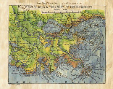
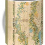
Review of 1858 Plantation Map
Mary Ann on Dec 12, 2017 5 out of 5 stars
“Wow! I can’t begin to describe how beautiful this map is as an original hand-painting. Will post pic after framing. Great communication with Artist. I highly recommend this shop. Thanks again, Lisa!”
See online! Click Here to study or Purchase Mississippi River Plantation Map 1858 36″ x 57″ vintage historic antique map original painting or print by Lisa Middleton
We’re excited! Great River Arts, our historic map publisher, is gradually taking over our collection of quality Mississippi River and they are making a special offering all four Volumes ofDiscover! America’s Great River Roadand the1887 “Father of Waters” Historic Reproduction of the full length of the Mississippi River.
This is an opportunity for you to save more than $30 on our most popular Book/Map Art Bundle!
Perfect for Gift Giving!Need extra maps? Everyone who loves our 1887 map by Lisa Middleton will love Discover! America’s Great River Road, our comprehensive guide to life along the river for their favorite section! Just CLICK HERE to purchase additional maps!
All Great River books can be ordered individually as well. CLICK HERE to go Straight to BOOKS on our new Shopping Cart at Great River Arts.
While mid-October seems to be the month when Fall Foliage really POPS along the Upper Mississippi River, it may be a little EARLIER this year. You can follow its southward march with the contacts below. Weather is perfect, enjoy the drive!
Arkansas. 800-628-8725; www.1800natural.com (late October to early November)
And don’t leave home without the indispensable guides to Mississippi River and Great River Road travel! Every volume of DISCOVER! America’s Great River Road is filled with a variety of fascinating Mississippi River fact and lore. Photos, maps, charts! All Volumes contain info on birding, wildlife viewing hotspots. Each highlights Geography, interpretive history and natural history attractions along the Great River Road.
SAVE $10!!! Purchase ALL FOUR VOLUMES of Discover! America’s Great River Road… St. Paul, Minnesota, to Venice, Louisiana, individually signed by the author. Four guides for $62.


 Now is the time to order your historic map ART for Christmas/Holiday gifting.


 “Wow! I can’t begin to describe how beautiful this map is as an original hand-painting. Will post pic after framing. Great communication with Artist. I highly recommend this shop. Thanks again, Lisa!”
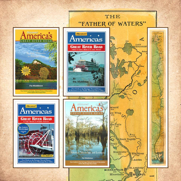
 individually as well.