Let us celebrate with historic French maps! Click on the maps to read detailed histories from Great River Arts… Lisa Middleton, Map Artist.Pause the curser over the map image and a magnifying glass with allow you to study the maps!!
We will do a different century through this coming week! First, the 18th Century.
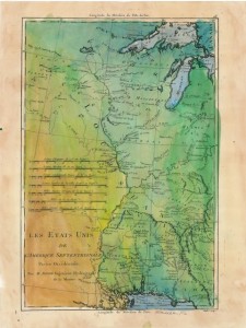
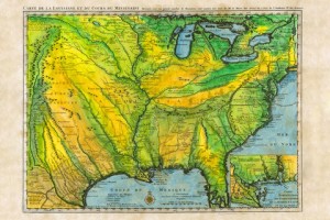
Les Etats Unis 1765 (approx)
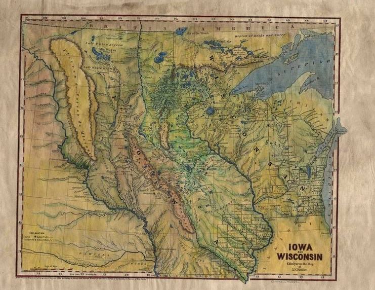
Iowa/Wisconsin Territory
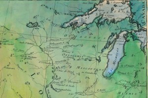
Les, Etats Unis, detail of Upper Mississippi River… “The Source of the River is Unknown..”
Ft Beauharnois near today’s Frontenac Minn
1731, De L’Isle’s CARTE DE LA LOUISIANE… With Lake Pepin Named on the Upper Mississippi River…. name requested by King Louis 14th!
Yes! If you have a special place that is part of your family history, a favorite vacation spot, or a property you’d like to feature on your wall, now is the time to contact Lisa about working on YOUR custom map.
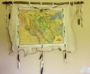
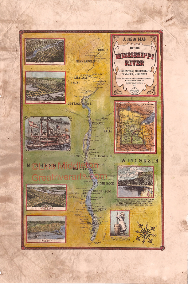
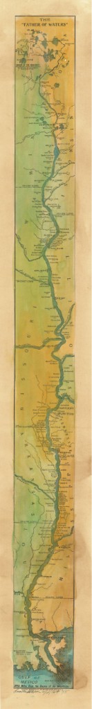
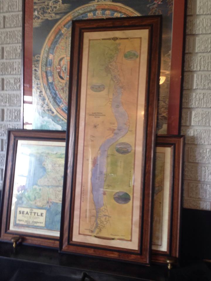
Ribbon Map of the entire Mississippi,
including Lake Glazier, MN. 1887
Drawn by Willard Glazier
This ribbon map was drawn by Captain Willard Glazier to “prove” his premise that the True Source of the Mississippi was Lake Glazier rather than Lake Itasca. Many modern-day towns are included in this survey, including Point Coupee in Louisiana. Many towns noted on the map…such as Waterproof… no longer exist!
“Mississippi
River Ribbon Maps”
from an article by Bob Mullen, for The Paddlewheel newsletter.
Imagine a map of the Mississippi River that shows all of the cities and towns along the river and all the landings where a steamboat might stop. Make the map about three inches wide and in one continuous strip showing the entire river from the Gulf of Mexico to its source at Lake Itasca, Minnesota. If you imagined correctly, you would have a map that is about eleven feet in length, like a long streamer or ribbon. Now roll up the map to a couple of inches in diameter and put into a cylindrical container that can easily fit into your pocket!
Such maps do exist. In 1866, Myron Coloney and Sidney B. Fairchild patented and published a map like this in St. Louis. In 1887, explorer Willard Glazier produced another ribbon map that included a lake he called Lake Willard, which he believed was the TRUE source of the Mississippi River. The 1866 map was sold commercially in St. Louis and along the river for a number of years. The maps were housed in a wooden cylinder with a rounded wooden cap at each end. On the side, a slot was cut where the map could be pulled out to give people a way to grasp it when pulling the map from its case. The patent granted the inventors was for “the idea or design ofmaps upon strips of any material,” as stated on the map itself. Glazier’s 1877 map was folded and printed with the guide to his canoe trip from Lake Willard in Minnesota to the Gulf. It includes most of the river villages we know today, as well as many which have since been washed away by Mississippi River flooding.
These maps both show considerable detail, but could never be used by a steamboat pilot for serious navigation. The river was much to complicated with islands, tricky bends, wing dams, and other obstacles to fit on a map like this. The ribbon map must have been made for the tourist or other traveler on the river who had enough expendable money to pay for such a souvenir. While the boat’s pilot had a detailed map to follow (often only in his memory), these ribbon maps served the traveler with a way to keep track of the boat’s progress on a long trip. It even pointed out a few points of interest. A notice in the July 10, 1866 Missouri Republican stated, “To the traveler, it will be an exciting guide and companion, and will furnish him with more information at a glance than he can secure from a constant questioning of the officers of the boat… to say nothing of avoiding a short answer from, or an immensity of annoyance to, these monarchs of our Mississippi River palaces.”
Only a handful of original ribbon maps exist today, scattered in museums across the country. The Smithsonian has one and the Missouri Historical Society of Missouri owns three Mississippi River ribbon maps. Each of these is extremely fragile and can no longer be handled. One of the maps at MHS is about eight inches wide, and has all the detail a riverboat pilot would need. Housed in a larger wooden box with a glass window, the map winds from a roll on one side of the window to a box on the other side of the window. The map in the window only shows an area some 30-40 miles… new scrolls could be set in place as the pilot traveled the length of the river.
In the 140 years since the first ribbon map appeared, nearly every one has disappeared. The Willard Glazier Reproduction here on www.greatriver.com is the only ribbon map we know of that is still available for sale to the public. Each map is either hand-stained to a sepia tone and parchment feel or is exquisitely hand-painted for framing.
Click here to see ALL of our beautiful antique Mississippi River maps online. Email or phone 888-255-7726 for more information!!
5×7″ notecards with portions of the painted maps are available for $4.95 each. Call for information or to request a certain map portion that is meaningful to you.
If you have friends in the Northwest, this is a good time to let them know about Lisa Middleton’s historic map paintings. Lisa is beginning her national show schedule in Montana/Washington/Colorado. Her Updated show schedule can always be seen at www.greatriverarts.com
I walked into Village Custom Frame in La Crosse, WI, the other day and found Sue busy at work filling orders for Lisa Middleton’s historic map prints ordered for Christmas giving. The framed maps 1887 Ribbon Maps are a GREAT idea for a corner nitch, or between two windows, or as a cabin feature!
If you don’t live in La Crosse, Stockholm, Alma, Winona, or Wabasha … where many of the frame shops sell Lisa’s maps already framed… you can now order FRAMED 1887 Mississippi River Ribbon maps at the Great River Publishing gift shop on ETSY.com
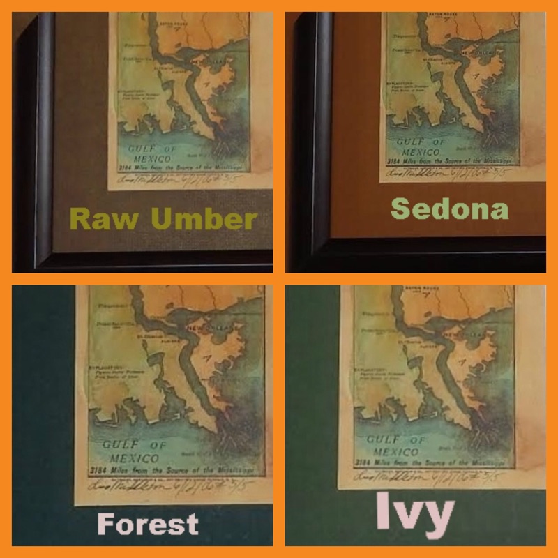
$225 includes choice of mat color (choose from those samples show) with a dark wooden frame.Maps can be shipped directly to the recipient!
Questions? Ready to order? Have another of Lisa’s historic map paintings you’d like framed and shipped? Want to frame the original painting? Call 406-471-7563 or go to ETSY.com to order online.
“Wonderful quality! Great detail. Love my map. Thank you!”
“I just LOVE my framed Mississippi River map! It was a challenge to find a map of the entire Mississippi, thankfully I found your shop! The colors are perfect, thank you!”
Our Mississippi River map artist, Lisa R Middleton, was featured in the FALL 2014 issue of the Montana Quarterly
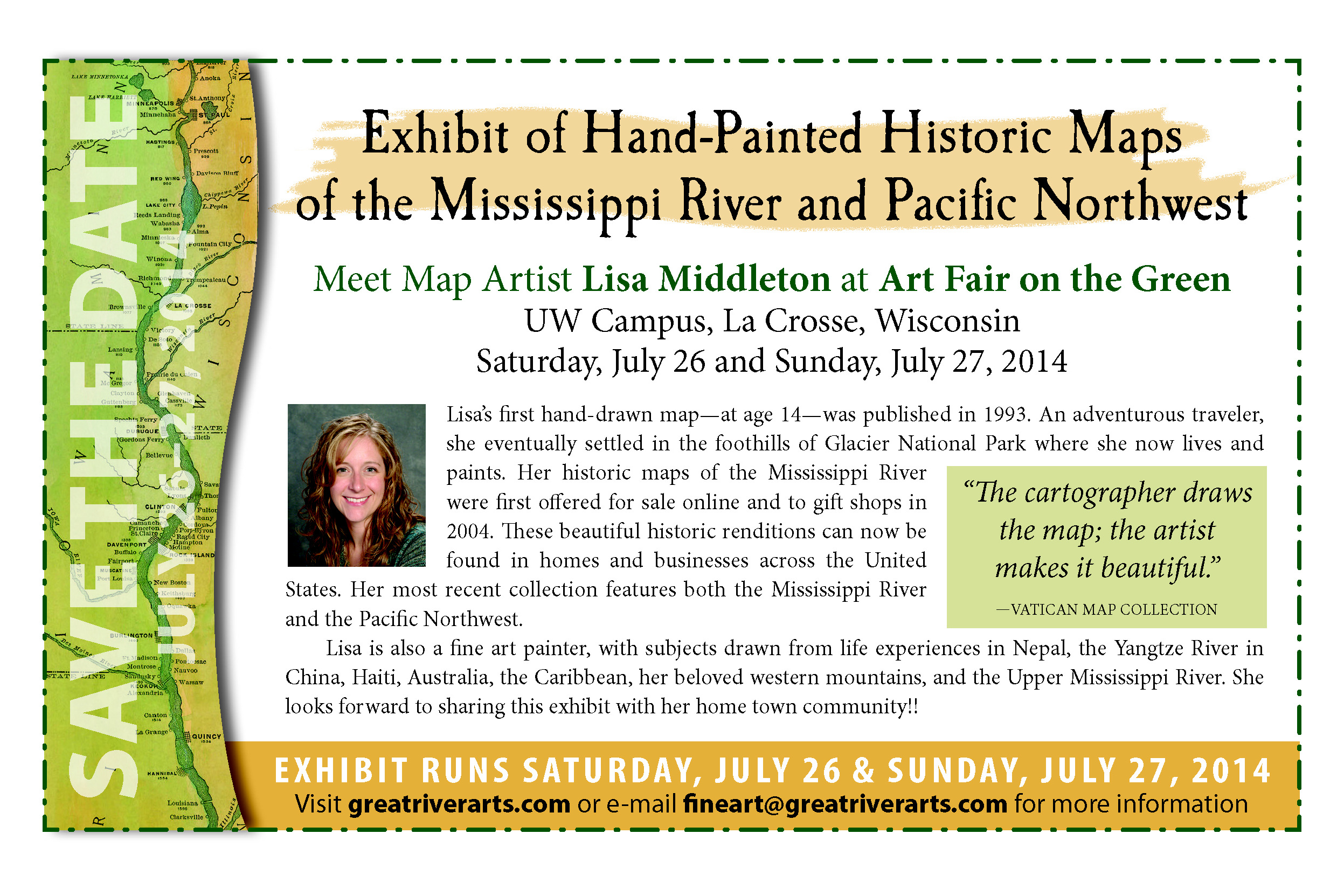
We’ve been lucky to have her on the river for the past 7-8 years, but she is expanding her territory westward. It was great having her on the Upper River for ART FAIR ON THE GREEN this summer. Thank you to everyone who expressed such enthusiasm for her Hisoric Map paintings and WELCOME to all our new owners!
Anyone who might like to see the 5-page spread should contact Montana Quarterly
Visit Lisa’s online blog, ART AT HEART, at www.greatriverarts.com ! Yes, she does accept special requests for original paintings!
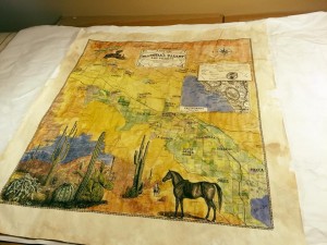
Plan to attend an outstanding juried art show… Art Fair on the Green… in La Crosse, Wisconsin, July 26/27. Mississippi River map artist, Lisa Middleton, will be featuring her hand-painted historic Mississippi River maps, including the “IOWA/WISCONSIN TERRITORY” map shown here. Purchase a gift print and ask Lisa to sign it! Originals and fine art Giclee reproductions available at this exhibit!
Our beautiful “New Map of Lake Pepin” drawn and illustrated by Wisconsin Map Artist, Lisa Middleton, is shown here framed. The gift prints are now available at better gift shops along both shores of the Upper Mississippi River for about $24.95. Or call us at 888-255-7726 to order!
The map, based on current USACE river charts is both historical and geographical in nature, with no commercial emphasis. The original painting and one full size giclee are available at Abode Gallery in Stockholm, Wisconsin. The original is close to 40″ long and 12″ wide. The gift prints which are a quality offset print product sized 11″x34″
Middleton also painted the 1887 Historic Reproduction of Glazier’s ribbon map, “The Father of Waters.” Gift prints of this map are also available at many fine gift shops along the river. Or call 888-255-7726 to order.
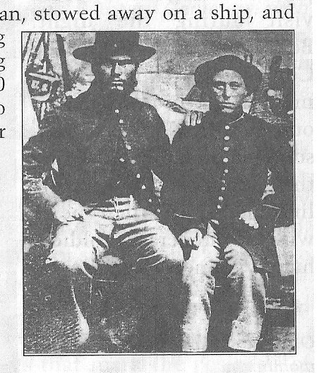
One of the more unusual stories from the Siege of Vicksburg came from the 95th Illinois Regiment. This regiment had a reputation as a particularly fierce group of fighters. Only 58% of the regiment had survived the previous Battle of Shiloh. Among those at Vicksburg was one they called “the fiercest of the fierce” — Albert D.J. Cashier.
When injured in a car accident in 1913, Albert (on right in photograph) refused medical help unless the doctor refused to reveal his secret… that Albert was a woman. Inevitably, the secret leaked out and a movement began to have Cashier’s name stricken from the Vicksburg monument. But in 1915, representatives of the regiment met in Chicago and signed a communication to the Illinois governor requesting that if any name was stricken from the regimental listing, then EVERY name must be stricken. Albert’s name is still listed to this day.
One knowledgeable researcher suspects that “Albert” was once engaged to a man named Albert in Ireland. When he was killed in an uprising, she committed herself to carrying on his life by following through on his dream to come to the United States. She dressed as a man, stowed away on a ship, and enrolled in the war using Albert’s name. At least 600 women are documented to have fought as men in the Civil War.
Insight excerpt from the Siege of Vicksburg, p. 78, Vol 4 of DISCOVER! America’s Great River Road by Pat Middleton. Used with permission. All rights reserved.


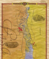
 Ribbon Map of the entire Mississippi,
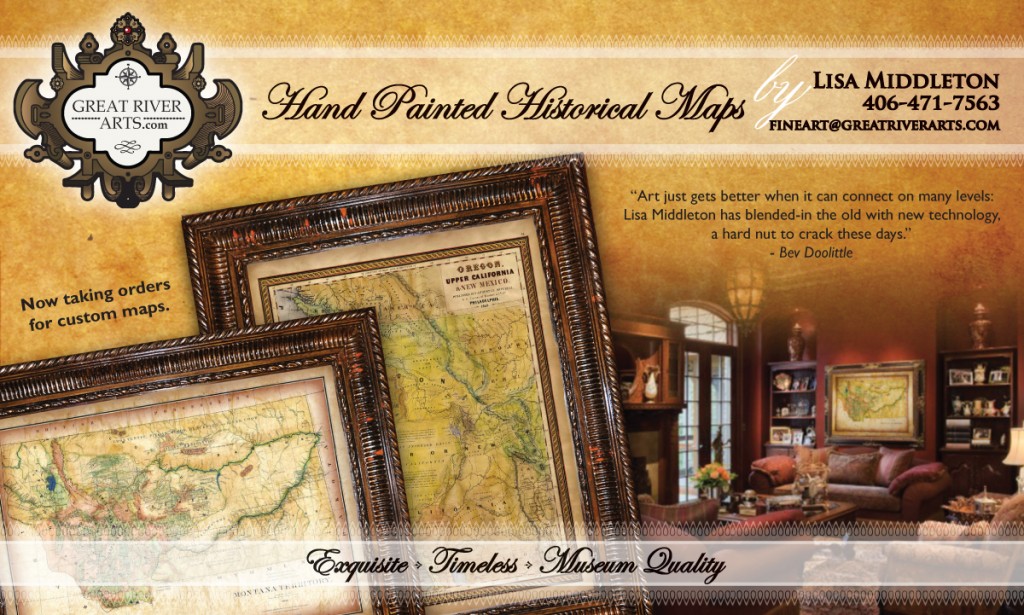


